29°30'0" N
47°45'0" E
~94m asl
23:30 (AST - UTC/GMT+3)
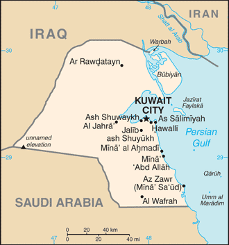
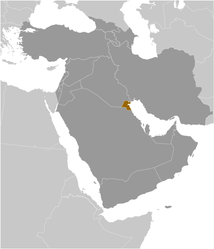
Dawlat al- Kuwait (Dawlat al- Kuwait) is a independent political entity (class A - Administrative Region) in Muhafazat al Wafrah (Kuwait (general)), Kuwait (Asia) with the region font code of Africa/Middle East. It is located at an elevation of 94 meters above sea level and its population amounts to 2,789,132.
Dawlat al- Kuwait is also known as Al Kuwait, Al Kuweit, Co-oet, Coweit, Cuait, Cuvaitum, Cuáit, Cô-oét, Dawlat al Kuwayt, Dawlat al-Kuwait, Dowlat al Kuwait, Koeweit, Koubeit, Koveyit, Kowait, Koweit, Kowet, Koweyt, Koweït, Kuvaeytaen, Kuvait, Kuvajt, Kuvajti, Kuvajto, Kuvehjt, Kuveit, Kuveita, Kuveitas, Kuvejt, Kuveyt, Kuväytän, Kuwait, Kuwait - alkwyt, Kuwait - الكويت, Kuwajt, Kuwayt, Kuweit, Kuwejt, Kuweyt, Kúveit, Quvayt, Shaikhdom of Kuwait, Sheikhdom of Kuwait, State of Kuwait, alkwyt, dawlat aalkuayt, ke wei te, khuwet, kuu~eto, kuvairr, kuvaita, kuvaittu, kuveiti, kuweiteu, kuyeta, kwwyt, kwwyyt, kwyt, prathes khuwet, Κουβέιτ, Кувайт, Кувајт, Кувейт, Кувэйт, Քուվեյթ, כוויית, כווית, الكويت, دَوْلَة اَلْكُوَيْت, كۇۋەيت, کویت, کویټ, ܟܘܘܝܬ, कुवैत, কুয়েত, குவைத்து, കുവൈറ്റ്, คูเวต, ประเทศคูเวต, ຄູເວດ, ཀུ་ཝེཊ, ཀུ་ཝེད་རྒྱལ་ཁབ།, კუვეიტი, ქუვეითი, ኩዌት ከተማ, ክዌት, គុយវ៉ែត, クウェート, 科威特, 쿠웨이트.
Its coordinates are 29°30'0" N and 47°45'0" E in DMS (Degrees Minutes Seconds) or 29.5 and 47.75 (in decimal degrees). Its UTM position is QT66 and its Joint Operation Graphics reference is NH38-12.
Current local time is 23:30; the sun rises at 08:54 and sets at 21:01 local time (Asia/Kuwait UTC/GMT+3). The standard time zone for Dawlat al- Kuwait is UTC/GMT+3
In 2024 DST starts on - and ends on -.
|
Advertisements:
Advertisements:
|

 Jal az Zawr (1 km)
  Khabrat Raji (2 km)
  Hamran (2 km)
  Khashm Ghudayy (2 km)
  Makhfar al Mirfi (2 km)
  Al `Awja' (3 km)
  Al `Awjah (3 km)
  Mu`taridah (4 km)
  Al Bitanah (5 km)
  Al Chuwaichib (5 km)
  Al Kuwaykib (5 km)
  Kawaikib (5 km)
  Kuwaykib (5 km)
  Makhfar ar Rudayyan (5 km)
  Makhfar ar Rudhayyan (5 km)
  Al Kharfashi (5 km)
  Dulay` Maadi (5 km)


