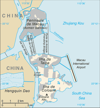
Macao Island
22°22'60" N
113°25'1" E
19:02 (CST - UTC/GMT+8)
Macao Island (Macao Island) is a island (class T - Hypsographic) in (Macau (general)), Macau S A R (Asia) with the region font code of Americas/Western Europe.
Its coordinates are 22°22'60" N and 113°25'1" E in DMS (Degrees Minutes Seconds) or 22.3833 and 113.417 (in decimal degrees). Its UTM position is GE47 and its Joint Operation Graphics reference is NF49-08.
Current local time is 19:02; the sun rises at 08:10 and sets at 20:17 local time (Asia/Macao UTC/GMT+8). The standard time zone for Macao Island is UTC/GMT+8
In 2025 DST starts on - and ends on -.
A Island is a tract of land, smaller than a continent, surrounded by water at high water.
|
Advertisements:
Advertisements:
|
Weather Macao Island (Cloud cover, Temperature, Wind speed and Precipitation mm probab.)
Sun Feb 16
18 °C min
26 °C max
16 km/h
Thu Jan 1
|
Mon Feb 17
16 °C min
23 °C max
23 km/h
Thu Jan 1
|
Tue Feb 18
16 °C min
21 °C max
24 km/h
Thu Jan 1
|
Wed Feb 19
16 °C min
20 °C max
22 km/h
Thu Jan 1
|
Thu Feb 20
17 °C min
23 °C max
21 km/h
Thu Jan 1
|
Fri Feb 21
17 °C min
22 °C max
18 km/h
Thu Jan 1
|
|
|
Map and Photos Macao Island
--- There are no comments yet ---
Add a new comment:
|
Members area
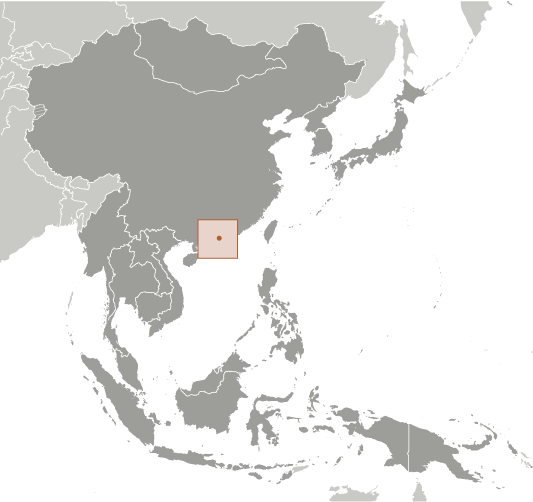
Macau S A R (Special Administrative Region):
Advertisement
GPS points near Macao Island
GPS points from Macau S A R (Special Administrative Region)
|