|
|
|
Weather Daḩl al Misfar (Cloud cover, Temperature, Wind speed and Precipitation mm probab.)
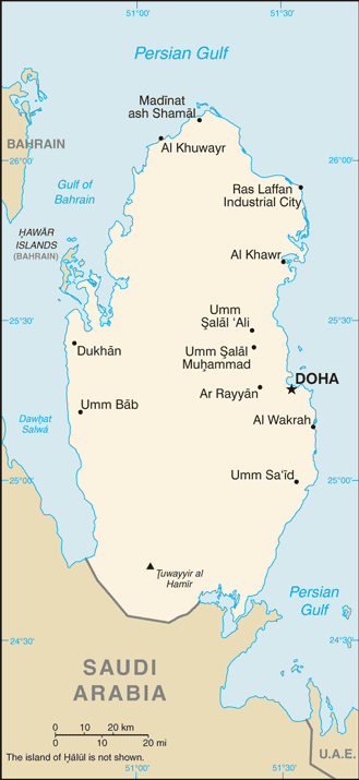
Map and Photos Dahl al Misfar
Comments
Add a new comment: |
Members area
Qatar (Doha):
Advertisement
GPS points near Daḩl al Misfar
 As Sahlah (2 km)
Sahla (2 km)
Sahlah (2 km)
Sehlah (2 km)
Raudhat Rashid (3 km)
Rawdat Rashid (3 km)
Umm Shamim (3 km)
Rawdat Rashid (3 km)
Umm ash Shubrum (4 km)
Sahalah (5 km)
Sahalla (5 km)
Sahallah (5 km)
Umm Samriyah (5 km)
Umm Samrya (5 km)
Al Khayriyah (5 km)
Umm al Shabrum (5 km)
Umm ash Shubrum (5 km)
As Sahlah (2 km)
Sahla (2 km)
Sahlah (2 km)
Sehlah (2 km)
Raudhat Rashid (3 km)
Rawdat Rashid (3 km)
Umm Shamim (3 km)
Rawdat Rashid (3 km)
Umm ash Shubrum (4 km)
Sahalah (5 km)
Sahalla (5 km)
Sahallah (5 km)
Umm Samriyah (5 km)
Umm Samrya (5 km)
Al Khayriyah (5 km)
Umm al Shabrum (5 km)
Umm ash Shubrum (5 km)
GPS points from Qatar (Doha)
|