English   Română   Español   Français   Deutsch  

getamap.net

Africa

Oceania

Asia

North America

Europe

South America

Antarctica


12°59'36" N
61°16'14" W
~1m asl
08:09 (AST - UTC/GMT--4)

Upper Bight (Upper Bight) is a cove(s) (class H - Hydrographic) in Saint Vincent and the Grenadines (general) (Saint Vincent and The Grenadines (general)), Saint Vincent And The Grenadines (North America) with the region font code of Americas/Western Europe. It is located at an elevation of 1 meters above sea level.

Its coordinates are 12°59'36" N and 61°16'14" W in DMS (Degrees Minutes Seconds) or 12.9933 and -61.2706 (in decimal degrees). Its UTM position is PV83 and its Joint Operation Graphics reference is ND20-16.

Current local time is 08:09; the sun rises at 08:54 and sets at 21:01 local time (America/St_Vincent UTC/GMT-4). The standard time zone for Upper Bight is UTC/GMT-4
In 2024 DST starts on - and ends on -.

A Cove(s) is a small coastal indentation, smaller than a bay.


Country
 Advertisements:


 Advertisements:


Weather Upper Bight (Cloud cover, Temperature, Wind speed and Precipitation mm probab.)

Tue


Apr 23
Clound 10-30-0-70
 
27 °C min
28 °C max
31 km/h
Thu Jan 1

Wed


Apr 24
Clound 10-40-0-40
 
27 °C min
28 °C max
28 km/h
Thu Jan 1

Thu


Apr 25
Clound 30-20-0-70 Mist Lightning
~9 l/m2 50%
 
26 °C min
28 °C max
32 km/h
Thu Jan 1

Fri


Apr 26
Clound 0-10-0-90
 
26 °C min
28 °C max
25 km/h
Thu Jan 1

Sat


Apr 27
Clound 10-30-0-60
~0.5 l/m2 22%
 
26 °C min
28 °C max
29 km/h
Thu Jan 1

Sun


Apr 28
Clound 10-10-30-50
~1 l/m2 19%
 
26 °C min
28 °C max
24 km/h
Thu Jan 1

Weather Graph

Upper Bight (Saint Vincent and the Grenadines (general)) 7 day forecast
 

Map and Photos Upper Bight


Comments

--- There are no comments yet ---


Add a new comment:


You have to log in to add a comment!


Members area


Register

Forgot password?

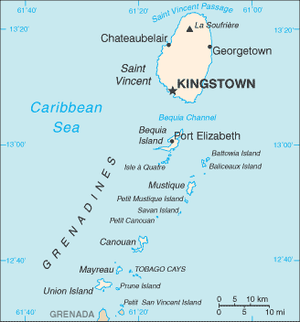
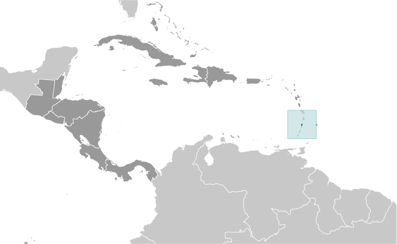
Saint Vincent And The Grenadines (Kingstown):

Advertisement


GPS points near Upper Bight

square Ships Stern (0.5km)

square Flat Point (0.5km)

square West Cay (1 km)

square Belle Point (2 km)

square Admiralty Bay (2 km)

square Derrick (2 km)

square Paget Farm (2 km)

square Lower Bay (2 km)

square Point Bay (2 km)

square Lawler Point (2 km)


square Wash Rock (3 km)

square Devil's Table (3 km)

square Rocky Bay (3 km)

square Point Peter (3 km)


GPS points from Saint Vincent And The Grenadines (Kingstown)

square Arnos Vale Parish Of Saint George

square The Pillories Grenadines

square Princes Town Parish Of Saint Patrick

square Prospect Saint Vincent And The Grenadines (general)

square Pigeon Island Grenadines

square Rabacca Dry River Parish Of Charlotte

square Lagoon Bay Grenadines

square Chatham Bay Grenadines


viewweather.com sv.ViewWeather.com
fr.ViewWeather.com
da.ViewWeather.com
de.ViewWeather.com
es.ViewWeather.com
www.carpati.org
www.searchromania.net
Deblocari usi
es.getamap.org
fr.getamap.org
de.getamap.org
nl.getamap.org
da.getamap.org
www.getamap.org
Links
Terms of use
Privacy policy

# 0.0650 sec 

contact AT getamap.net

© 2006 - 2024  https://www.getamap.net/