|

Administrative divisions (GPS Maps)
Geography
People and Society
Government
Economy
Communications
Transportation
Military |
 |
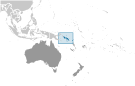 The UK established a protectorate over the Solomon Islands in the 1890s. Some of the most bitter fighting of World War II occurred on this archipelago. Self-government was achieved in 1976 and independence two years later. Ethnic violence, government malfeasance, and endemic crime have undermined stability and civil society. In June 2003, then Prime Minister Sir Allan KEMAKEZA sought the assistance of Australia in reestablishing law and order; the following month, an Australian-led multinational force arrived to restore peace and disarm ethnic militias. The Regional Assistance Mission to the Solomon Islands (RAMSI) has generally been effective in restoring law and order and rebuilding government institutions. The UK established a protectorate over the Solomon Islands in the 1890s. Some of the most bitter fighting of World War II occurred on this archipelago. Self-government was achieved in 1976 and independence two years later. Ethnic violence, government malfeasance, and endemic crime have undermined stability and civil society. In June 2003, then Prime Minister Sir Allan KEMAKEZA sought the assistance of Australia in reestablishing law and order; the following month, an Australian-led multinational force arrived to restore peace and disarm ethnic militias. The Regional Assistance Mission to the Solomon Islands (RAMSI) has generally been effective in restoring law and order and rebuilding government institutions. |
|
Advertisements
|
Advertisements
|
Administrative divisions (11,778 GPS Maps)
--- There are no comments yet ---
Add a new comment:
|
Advertisement
Members area
Solomon Islands (Honiara):
GPS points from Solomon Islands (Honiara)
 Mbopo Solomon Islands (general)
Puto Solomon Islands (general)
|
