|
|
|
Advertisements:
GeographyLocation
Northern Africa, bordering the Mediterranean Sea, between Morocco and Tunisia Geographic coordinates
28 00 N, 3 00 E
Map references
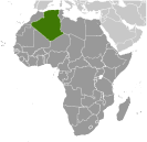
Africa
Area World Ranking: 10
Total 2,381,741 sq km
Land 2,381,741 sq km Water 0 sq km Area - comparative
Slightly less than 3.5 times the size of Texas Land boundaries
Total 6,343 km
Border countries Libya 982 km, Mali 1,376 km, Mauritania 463 km, Morocco 1,559 km, Niger 956 km, Tunisia 965 km, Western Sahara 42 km Coastline
998 km
Maritime claims
Territorial sea 12 nm
Exclusive fishing zone 32-52 nm Climate
Arid to semiarid; mild, wet winters with hot, dry summers along coast; drier with cold winters and hot summers on high plateau; sirocco is a hot, dust/sand-laden wind especially common in summer Terrain
Mostly high plateau and desert; some mountains; narrow, discontinuous coastal plain Elevation extremes
Lowest point Chott Melrhir -40 m
Highest point Tahat 3,003 m Natural resources
Petroleum, natural gas, iron ore, phosphates, uranium, lead, zinc Land use
Arable land 3.17%
Permanent crops 0.28% Other 96.55% (2005) Irrigated land
5,700 sq km (2003)
Total renewable water resources
14.3 cu km (1997)
Freshwater withdrawal (domestic/industrial/agricultural)
Total 6.07 cu km/yr (22%/13%/65%)
Per capita 185 cu m/yr (2000) Natural hazards
Mountainous areas subject to severe earthquakes; mudslides and floods in rainy season Environment - current issues
Soil erosion from overgrazing and other poor farming practices; desertification; dumping of raw sewage, petroleum refining wastes, and other industrial effluents is leading to the pollution of rivers and coastal waters; Mediterranean Sea, in particular, becoming polluted from oil wastes, soil erosion, and fertilizer runoff; inadequate supplies of potable water Environment - international agreements
Party to
Biodiversity, Climate Change, Climate Change-Kyoto Protocol, Desertification, Endangered Species, Environmental Modification, Hazardous Wastes, Law of the Sea, Ozone Layer Protection, Ship Pollution, Wetlands Signed, but not ratified None of the selected agreements Geography - note
Largest country in Africa
Comments
Add a new comment: |
Advertisement
Members area
Algeria (Algiers):
 
GPS points from Algeria (Algiers)
|
||||||||

 After more than a century of rule by France, Algerians fought through much of the 1950s to achieve independence in 1962. Algeria's primary political party, the National Liberation Front (FLN), was established in 1954 as part of the struggle for independence and has largely dominated politics since. The Government of Algeria in 1988 instituted a multi-party system in response to public unrest, but the surprising first round success of the Islamic Salvation Front (FIS) in the December 1991 balloting spurred the Algerian army to intervene and postpone the second round of elections to prevent what the secular elite feared would be an extremist-led government from assuming power. The army began a crackdown on the FIS that spurred FIS supporters to begin attacking government targets, and fighting escalated into an insurgency, which saw intense violence between 1992-98 resulting in over 100,000 deaths - many attributed to indiscriminate massacres of villagers by extremists. The government gained the upper hand by the late-1990s, and FIS's armed wing, the Islamic Salvation Army, disbanded in January 2000. Abdelaziz BOUTEFLIKA, with the backing of the military, won the presidency in 1999 in an election widely viewed as fraudulent. He was reelected to a second term in 2004 and overwhelmingly won a third term in 2009 after the government amended the constitution in 2008 to remove presidential term limits. Longstanding problems continue to face BOUTEFLIKA, including large-scale unemployment, a shortage of housing, unreliable electrical and water supplies, government inefficiencies and corruption, and the continuing activities of extremist militants. The Salafist Group for Preaching and Combat (GSPC) in 2006 merged with al-Qa'ida to form al-Qa'ida in the Lands of the Islamic Maghreb, which has launched an ongoing series of kidnappings and bombings targeting the Algerian Government and Western interests. The government in 2011 introduced some political reforms in response to the Arab Spring, including lifting the 19-year-old state of emergency restrictions, ending the state's monopoly on broadcast media, increasing women's quotas for elected assemblies, and expanding the role of judges in administering elections. Political protest activity in the country remained low in 2011, but small, sometimes violent socioeconomic demonstrations by disparate groups continued to be a common occurrence. Parliamentary elections held in May 2012 resulted in an increase of seats for presidentially-aligned parties. Parliament in 2013 is expected to revise the constitution.