|
|
|
Advertisements:
GeographyLocation
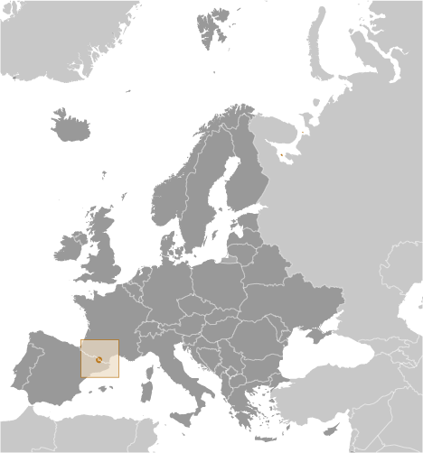
Southwestern Europe, Pyrenees mountains, on the border between France and Spain Geographic coordinates
42 30 N, 1 30 E
Map references
Europe
Area World Ranking: 195
Total 468 sq km
Land 468 sq km Water 0 sq km Area - comparative
2.5 times the size of Washington, DC Land boundaries
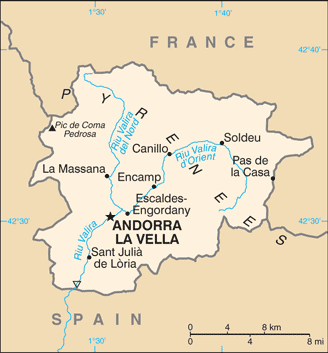
Total 120.3 km
Border countries France 56.6 km, Spain 63.7 km Coastline
0 km (landlocked)
Maritime claims
None (landlocked)
Climate
Temperate; snowy, cold winters and warm, dry summers Terrain
Rugged mountains dissected by narrow valleys Elevation extremes
Lowest point Riu Runer 840 m
Highest point Pic de Coma Pedrosa 2,946 m Natural resources
Hydropower, mineral water, timber, iron ore, lead Land use
Arable land 2.13%
Permanent crops 0% Other 97.87% (2005) Irrigated land
NA
Natural hazards
Avalanches
Environment - current issues
Deforestation; overgrazing of mountain meadows contributes to soil erosion; air pollution; wastewater treatment and solid waste disposal Environment - international agreements
Party to
Biodiversity, Desertification, Hazardous Wastes, Ozone Layer Protection Signed, but not ratified None of the selected agreements Geography - note
Landlocked; straddles a number of important crossroads in the Pyrenees
Comments
Add a new comment: |
Advertisement
Members area
Andorra (Andorra La Vella):
GPS points from Andorra (Andorra La Vella)
|
||||||||
 For 715 years, from 1278 to 1993, Andorrans lived under a unique co-principality, ruled by French and Spanish leaders (from 1607 onward, the French chief of state and the Spanish bishop of Seu d'Urgell). In 1993, this feudal system was modified with the titular heads of state retained, but the government transformed into a parliamentary democracy. For decades Andorra enjoyed its status as a small refuge of fiscal and banking freedom and benefitted from Spanish and French tourists attracted to the country's duty-free shopping. The situation has changed in recent years as Andorra started to tax foreign investment and other sectors. Tourism accounts for over 80% of Andorra's gross domestic product.