|
|
Advertisements:
GeographyLocation
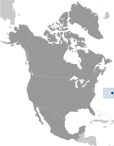
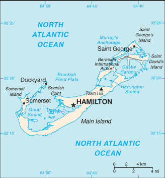
North America, group of islands in the North Atlantic Ocean, east of South Carolina (US) Geographic coordinates
32 20 N, 64 45 W
Map references
North America
Area World Ranking: 231
Total 54 sq km
Land 54 sq km Water 0 sq km Area - comparative
About one-third the size of Washington, DC Land boundaries
0 km
Coastline
103 km
Maritime claims
Territorial sea 12 nm
Exclusive fishing zone 200 nm Climate
Subtropical; mild, humid; gales, strong winds common in winter Terrain
Low hills separated by fertile depressions Elevation extremes
Lowest point Atlantic Ocean 0 m
Highest point Town Hill 76 m Natural resources
Limestone, pleasant climate fostering tourism Land use
Arable land 20%
Permanent crops 0% Other 80% (55% developed, 45% rural/open space) (2005) Irrigated land
NA
Natural hazards
Hurricanes (June to November)
Environment - current issues
Sustainable development
Geography - note
Consists of about 138 coral islands and islets with ample rainfall, but no rivers or freshwater lakes; some land was leased by the US Government from 1941 to 1995
Comments
Add a new comment: |
Advertisement
Members area
Bermuda [ United Kingdom ] (Overseas Territory):
 
GPS points from Bermuda [ United Kingdom ] (Overseas Territory)
|
||||||||

 Bermuda was first settled in 1609 by shipwrecked English colonists headed for Virginia. Tourism to the island to escape North American winters first developed in Victorian times. Tourism continues to be important to the island's economy, although international business has overtaken it in recent years. Bermuda has also developed into a highly successful offshore financial center. A referendum on independence from the UK was soundly defeated in 1995.