|
|
|
Advertisements:
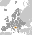
GeographyLocation
Southeastern Europe, bordering the Adriatic Sea and Croatia Geographic coordinates
44 00 N, 18 00 E
Map references
Europe
Area World Ranking: 129
Total 51,197 sq km
Land 51,187 sq km Water 10 sq km Area - comparative
Slightly smaller than West Virginia Land boundaries
Total 1,538 km
Border countries Croatia 932 km, Montenegro 249 km, Serbia 357 km Coastline
20 km
Maritime claims
No data available
Climate
Hot summers and cold winters; areas of high elevation have short, cool summers and long, severe winters; mild, rainy winters along coast Terrain
Mountains and valleys
Elevation extremes
Lowest point Adriatic Sea 0 m
Highest point Maglic 2,386 m Natural resources
Coal, iron ore, bauxite, copper, lead, zinc, chromite, cobalt, manganese, nickel, clay, gypsum, salt, sand, timber, hydropower Land use
Arable land 19.61%
Permanent crops 1.89% Other 78.5% (2005) Irrigated land
30 sq km (2003)
Total renewable water resources
37.5 cu km (2003)
Natural hazards
Destructive earthquakes
Environment - current issues
Air pollution from metallurgical plants; sites for disposing of urban waste are limited; water shortages and destruction of infrastructure because of the 1992-95 civil strife; deforestation Environment - international agreements
Party to
Air Pollution, Biodiversity, Climate Change, Climate Change-Kyoto Protocol, Desertification, Hazardous Wastes, Law of the Sea, Marine Life Conservation, Ozone Layer Protection, Wetlands Signed, but not ratified None of the selected agreements Geography - note
Within Bosnia and Herzegovina's recognized borders, the country is divided into a joint Bosniak/Croat Federation (about 51% of the territory) and the Bosnian Serb-led Republika Srpska or RS (about 49% of the territory); the region called Herzegovina is contiguous to Croatia and Montenegro, and traditionally has been settled by an ethnic Croat majority in the west and an ethnic Serb majority in the east
Comments
Add a new comment: |
Advertisement
Members area
Bosnia And Herzegovina (Sarajevo):
 
GPS points from Bosnia And Herzegovina (Sarajevo)
|
||||||||

 Bosnia and Herzegovina's declaration of sovereignty in October 1991 was followed by a declaration of independence from the former Yugoslavia on 3 March 1992 after a referendum boycotted by ethnic Serbs. The Bosnian Serbs - supported by neighboring Serbia and Montenegro - responded with armed resistance aimed at partitioning the republic along ethnic lines and joining Serb-held areas to form a "Greater Serbia." In March 1994, Bosniaks and Croats reduced the number of warring factions from three to two by signing an agreement creating a joint Bosniak/Croat Federation of Bosnia and Herzegovina. On 21 November 1995, in Dayton, Ohio, the warring parties initialed a peace agreement that brought to a halt three years of interethnic civil strife (the final agreement was signed in Paris on 14 December 1995). The Dayton Peace Accords retained Bosnia and Herzegovina's international boundaries and created a multi-ethnic and democratic government charged with conducting foreign, diplomatic, and fiscal policy. Also recognized was a second tier of government composed of two entities roughly equal in size: the Bosniak/Bosnian Croat Federation of Bosnia and Herzegovina and the Bosnian Serb-led Republika Srpska (RS). The Federation and RS governments were charged with overseeing most government functions. The Dayton Accords also established the Office of the High Representative (OHR) to oversee the implementation of the civilian aspects of the agreement. The Peace Implementation Council (PIC) at its conference in Bonn in 1997 also gave the High Representative the authority to impose legislation and remove officials, the so-called "Bonn Powers." In 1995-96, a NATO-led international peacekeeping force (IFOR) of 60,000 troops served in Bosnia to implement and monitor the military aspects of the agreement. IFOR was succeeded by a smaller, NATO-led Stabilization Force (SFOR) whose mission was to deter renewed hostilities. European Union peacekeeping troops (EUFOR) replaced SFOR in December 2004; their mission is to maintain peace and stability throughout the country. EUFOR's mission changed from peacekeeping to civil policing in October 2007, with its presence reduced from nearly 7,000 to less than 2,500 troops. Currently EUFOR deploys around 1,300 troops in theater.