|
|
|
Advertisements:
GeographyLocation
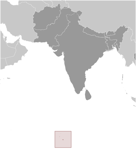
Archipelago in the Indian Ocean, south of India, about halfway between Africa and Indonesia Geographic coordinates
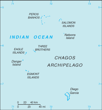
6 00 S, 71 30 E; note - Diego Garcia 7 20 S, 72 25 E Map references
Political Map of the World
Area World Ranking: 128
Total 54,400 sq km
Land 60 sq km; Diego Garcia 44 sq km Water 54,340 sq kmNote Includes the entire Chagos Archipelago of 55 islands Area - comparative
Land area is about 0.3 times the size of Washington, DC Land boundaries
0 km
Coastline
698 km
Maritime claims
Territorial sea 3 nm
Exclusive fishing zone 200 nm Climate
Tropical marine; hot, humid, moderated by trade winds Terrain
Flat and low (most areas do not exceed two meters in elevation) Elevation extremes
Lowest point Indian Ocean 0 m
Highest point Unnamed location on Diego Garcia 15 m Natural resources
Coconuts, fish, sugarcane
Land use
Arable land 0%
Permanent crops 0% Other 100% (2005) Irrigated land
0 sq km
Natural hazards
NA
Environment - current issues
NA
Geography - note
Archipelago of 55 islands; Diego Garcia, largest and southernmost island, occupies strategic location in central Indian Ocean; island is site of joint US-UK military facility
Comments
Add a new comment: |
Advertisement
Members area
British Indian Ocean Territory [ United Kingdom ] (Overseas Territory):
GPS points from British Indian Ocean Territory [ United Kingdom ] (Overseas Territory)
|
||||||||
 Formerly administered as part of the British Crown Colony of Mauritius, the British Indian Ocean Territory (BIOT) was established as an overseas territory of the UK in 1965. A number of the islands of the territory were later transferred to the Seychelles when it attained independence in 1976. Subsequently, BIOT has consisted only of the six main island groups comprising the Chagos Archipelago. The largest and most southerly of the islands, Diego Garcia, contains a joint UK-US naval support facility. All of the remaining islands are uninhabited. Between 1967 and 1973, former agricultural workers, earlier residents in the islands, were relocated primarily to Mauritius, but also to the Seychelles. Negotiations between 1971 and 1982 resulted in the establishment of a trust fund by the British Government as compensation for the displaced islanders, known as Chagossians. Beginning in 1998, the islanders pursued a series of lawsuits against the British Government seeking further compensation and the right to return to the territory. In 2006 and 2007, British court rulings invalidated the immigration policies contained in the 2004 BIOT Constitution Order that had excluded the islanders from the archipelago, but upheld the special military status of Diego Garcia. In 2008, the House of Lords, as the final court of appeal in the UK, ruled in favor of the British Government by overturning the lower court rulings and finding no right of return for the Chagossians.