|
|
|
Advertisements:
TransportationAirports World Ranking: 75
69 (2012)
Airports - with paved runways
Total 24
Over 3,047 m 2 2,438 to 3,047 m 6 1,524 to 2,437 m 3 914 to 1,523 m 3 Under 914 m 10 (2012) Airports - with unpaved runways
Total 45
1,524 to 2,437 m 1 914 to 1,523 m 6 Under 914 m 38 (2012) Heliports
1 (2012)
Pipelines
Gas 1,686 km; oil 532 km (2010) Railways World Ranking: 60
Total 2,722 km
Standard gauge 2,722 km 1.435-m gauge (984 km electrified) (2009) Roadways World Ranking: 99
Total
29,343 km (includes 1,047 km of expressways) (2008) Waterways World Ranking: 74
785 km (2009)
Merchant marine World Ranking: 57
Total 77
By type Bulk carrier 24, cargo 7, chemical tanker 8, passenger/cargo 27, petroleum tanker 10, refrigerated cargo 1 Foreign-owned 2 (Norway 2)Registered in other countries 31 (Bahamas 1, Belize 1, Liberia 1, Malta 6, Marshall Islands 12, Panama 2, Saint Vincent and the Grenadines 8) (2010) Ports and terminals
Omisalj, Ploce, Rijeka, Sibernik, Split, Vukovar (on Danube River)
Comments
Add a new comment: |
Advertisement
Members area
Croatia (Zagreb):
 
GPS points from Croatia (Zagreb)
|
||||||||

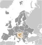 The lands that today comprise Croatia were part of the Austro-Hungarian Empire until the close of World War I. In 1918, the Croats, Serbs, and Slovenes formed a kingdom known after 1929 as Yugoslavia. Following World War II, Yugoslavia became a federal independent Communist state under the strong hand of Marshal TITO. Although Croatia declared its independence from Yugoslavia in 1991, it took four years of sporadic, but often bitter, fighting before occupying Serb armies were mostly cleared from Croatian lands, along with a majority of Croatia's ethnic Serb population. Under UN supervision, the last Serb-held enclave in eastern Slavonia was returned to Croatia in 1998. In April 2009, Croatia joined NATO; Croatia signed the EU Accession Treaty in December 2011 and ratified the Treaty in January, 2012. Croatia will become a member after all 27 EU members ratify the treaty, with a target date of July 2013.