|
|
|
Advertisements:
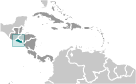
GeographyLocation
Central America, bordering the North Pacific Ocean, between Guatemala and Honduras Geographic coordinates
13 50 N, 88 55 W
Map references
Central America and the Caribbean
Area World Ranking: 153
Total 21,041 sq km
Land 20,721 sq km Water 320 sq km Area - comparative
Slightly smaller than Massachusetts Land boundaries
Total 545 km
Border countries Guatemala 203 km, Honduras 342 km Coastline
307 km
Maritime claims
Territorial sea 12 nm
Contiguous zone 24 nm Exclusive economic zone 200 nm Climate
Tropical; rainy season (May to October); dry season (November to April); tropical on coast; temperate in uplands Terrain
Mostly mountains with narrow coastal belt and central plateau Elevation extremes
Lowest point Pacific Ocean 0 m
Highest point Cerro El Pital 2,730 m Natural resources
Hydropower, geothermal power, petroleum, arable land Land use
Arable land 31.37%
Permanent crops 11.88% Other 56.75% (2005) Irrigated land
450 sq km (2003)
Total renewable water resources
25.2 cu km (2001)
Freshwater withdrawal (domestic/industrial/agricultural)
Total 1.28 cu km/yr (25%/16%/59%)
Per capita 186 cu m/yr (2000) Natural hazards
Known as the Land of Volcanoes; frequent and sometimes destructive earthquakes and volcanic activity; extremely susceptible to hurricanes Volcanism Significant volcanic activity; San Salvador (elev. 1,893 m), which last erupted in 1917, has the potential to cause major harm to the country's capital, which lies just below the volcano's slopes; San Miguel (elev. 2,130 m), which last erupted in 2002, is one of the most active volcanoes in the country; other historically active volcanoes include Conchaguita, Ilopango, Izalco, and Santa Ana Environment - current issues
Deforestation; soil erosion; water pollution; contamination of soils from disposal of toxic wastes Environment - international agreements
Party to
Biodiversity, Climate Change, Climate Change-Kyoto Protocol, Desertification, Endangered Species, Hazardous Wastes, Ozone Layer Protection, Wetlands Signed, but not ratified Law of the SeaGeography - note
Smallest Central American country and only one without a coastline on Caribbean Sea
Comments
Add a new comment: |
Advertisement
Members area
El Salvador (San Salvador):
 
GPS points from El Salvador (San Salvador)
|
||||||||

 El Salvador achieved independence from Spain in 1821 and from the Central American Federation in 1839. A 12-year civil war, which cost about 75,000 lives, was brought to a close in 1992 when the government and leftist rebels signed a treaty that provided for military and political reforms.