|
|
|
Advertisements:
GeographyLocation
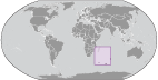
Southeast and east of Africa, islands in the southern Indian Ocean, some near Madagascar and others about equidistant between Africa, Antarctica, and Australia; note - French Southern and Antarctic Lands include Ile Amsterdam, Ile Saint-Paul, Iles Crozet, Iles Kerguelen, Bassas da India, Europa Island, Glorioso Islands, Juan de Nova Island, and Tromelin Island in the southern Indian Ocean, along with the French-claimed sector of Antarctica, "Adelie Land"; the US does not recognize the French claim to "Adelie Land" Geographic coordinates
Ile Amsterdam (Ile Amsterdam et Ile Saint-Paul) 37 50 S, 77 32 E
Ile Saint-Paul (Ile Amsterdam et Ile Saint-Paul) 38 72 S, 77 53 E Iles Crozet 46 25 S, 51 00 E Iles Kerguelen 49 15 S, 69 35 E Bassas da India (Iles Eparses) 21 30 S, 39 50 E Europa Island (Iles Eparses) 22 20 S, 40 22 E Glorioso Islands (Iles Eparses) 11 30 S, 47 20 E Juan de Nova Island (Iles Eparses) 17 03 S, 42 45 E Tromelin Island (Iles Eparses) 15 52 S, 54 25 E Map references
Antarctic Region
Area World Ranking: 229
Ile Amsterdam (Ile Amsterdam et Ile Saint-Paul)
Total - 55 sq km; land - 55 sq km; water - 0 sq km Ile Saint-Paul (Ile Amsterdam et Ile Saint-Paul) Total - 7 sq km; land - 7 sq km; water - 0 sq km Iles Crozet Total - 352 sq km; land - 352 sq km; water - 0 sq km Iles Kerguelen Total - 7,215 sq km; land - 7,215 sq km; water - 0 sq km Bassas da India (Iles Eparses) Total - 80 sq km; land - 0.2 sq km; water - 79.8 sq km (lagoon) Europa Island (Iles Eparses) Total - 28 sq km; land - 28 sq km; water - 0 sq km Glorioso Islands (Iles Eparses) Total - 5 sq km; land - 5 sq km; water - 0 sq km Juan de Nova Island (Iles Eparses) Total - 4.4 sq km; land - 4.4 sq km; water - 0 sq km Tromelin Island (Iles Eparses) Total - 1 sq km; land - 1 sq km; water - 0 sq km Note Excludes "Adelie Land" claim of about 500,000 sq km in Antarctica that is not recognized by the US Area - comparative
Ile Amsterdam (Ile Amsterdam et Ile Saint-Paul)
Less than one-half the size of Washington, DC Ile Saint-Paul (Ile Amsterdam et Ile Saint-Paul) More than 10 times the size of The Mall in Washington, DC Iles Crozet About twice the size of Washington, DC Iles Kerguelen Slightly larger than DelawareBassas da India (Iles Eparses) Land area about one-third the size of The Mall in Washington, DC Europa Island (Iles Eparses) About one-sixth the size of Washington, DC Glorioso Islands (Iles Eparses) About eight times the size of The Mall in Washington, DC Juan de Nova Island (Iles Eparses) About seven times the size of The Mall in Washington, DC Tromelin Island (Iles Eparses) About 1.7 times the size of The Mall in Washington, DC Land boundaries
0 km
Coastline
Ile Amsterdam (Ile Amsterdam et Ile Saint-Paul) 28 km
Ile Saint-Paul (Ile Amsterdam et Ile Saint-Paul) Iles Kerguelen 2,800 km Bassas da India (Iles Eparses) 35.2 km Europa Island (Iles Eparses) 22.2 km Glorioso Islands (Iles Eparses) 35.2 km Juan de Nova Island (Iles Eparses) 24.1 km Tromelin Island (Iles Eparses) 3.7 km Maritime claims
Territorial sea 12 nm
Exclusive economic zone 200 nm from Iles Kerguelen and Iles Eparses (does not include the rest of French Southern and Antarctic Lands); Juan de Nova Island and Tromelin Island claim a continental shelf of 200-m depth or to the depth of exploitation Climate
Ile Amsterdam et Ile Saint-Paul
Oceanic with persistent westerly winds and high humidity Iles Crozet Windy, cold, wet, and cloudyIles Kerguelen Oceanic, cold, overcast, windy Iles Eparses Tropical Terrain
Ile Amsterdam (Ile Amsterdam et Ile Saint-Paul)
A volcanic island with steep coastal cliffs; the center floor of the volcano is a large plateau Ile Saint-Paul (Ile Amsterdam et Ile Saint-Paul) Triangular in shape, the island is the top of a volcano, rocky with steep cliffs on the eastern side; has active thermal springs Iles Crozet A large archipelago formed from the Crozet Plateau is divided into two groups of islands Iles Kerguelen The interior of the large island of Ile Kerguelen is composed of rugged terrain of high mountains, hills, valleys, and plains with a number of peninsulas stretching off its coasts Bassas da India (Iles Eparses) Atoll, awash at high tide; shallow (15 m) lagoon Europa Island, Glorioso Islands, Juan de Nova Island Low, flat, and sandyTromelin Island (Iles Eparses) Low, flat, sandy; likely volcanic seamount Elevation extremes
Lowest point Indian Ocean 0 m
Highest point Mont de la Dives on Ile Amsterdam (Ile Amsterdam et Ile Saint-Paul) 867 m; unnamed location on Ile Saint-Paul (Ile Amsterdam et Ile Saint-Paul) 272 m; Pic Marion-Dufresne in Iles Crozet 1,090 m; Mont Ross in Iles Kerguelen 1,850 m; unnamed location on Bassas de India (Iles Eparses) 2.4 m; unnamed location on Europa Island (Iles Eparses) 24 m; unnamed location on Glorioso Islands (Iles Eparses) 12 m; unnamed location on Juan de Nova Island (Iles Eparses) 10 m; unnamed location on Tromelin Island (Iles Eparses) 7 m Natural resources
Fish, crayfish
Note Glorioso Islands and Tromelin Island (Iles Eparses) have guano, phosphates, and coconuts Land use
Ile Amsterdam (Ile Amsterdam et Ile Saint-Paul) - 100% trees, grasses, ferns, and moss; Ile Saint-Paul (Ile Amsterdam et Ile Saint-Paul) - 100% grass, ferns, and moss; Iles Crozet - 100% tossock grass, heath, and fern; Iles Kerguelen - 100% tossock grass and Kerguelen cabbage; Bassas da India (Iles Eparses) - 100% rock, coral reef, and sand; Europa Island (Iles Eparses) - 100% mangrove swamp and dry woodlands; Glorioso Islands (Iles Eparses) - 100% lush vegetation and coconut palms; Juan de Nova Island (Iles Eparses) - 90% forest, 10% other; Tromelin Island (Iles Eparses) - 100% grasses and scattered brush (2005) Irrigated land
0 sq km
Natural hazards
Ile Amsterdam and Ile Saint-Paul are inactive volcanoes; Iles Eparses subject to periodic cyclones; Bassas da India is a maritime hazard since it is under water for a period of three hours prior to and following the high tide and surrounded by reefs Volcanism Reunion Island - Piton de la Fournaise (elev. 2,632 m, ), which has erupted many times in recent years including 2010, is one of the world's most active volcanoes; although rare, eruptions outside the volcano's caldera could threaten nearby cities Environment - current issues
Introduction of foreign species on Iles Crozet has caused severe damage to the original ecosystem; overfishing of Patagonian toothfish around Iles Crozet and Iles Kerguelen Geography - note
Islands component is widely scattered across remote locations in the southern Indian Ocean Bassas da India (Iles Eparses) The atoll is a circular reef that sits atop a long-extinct, submerged volcano Europa Island and Juan de Nova Island (Iles Eparses) Wildlife sanctuary for seabirds and sea turtles Glorioso Island (Iles Eparses) The islands and rocks are surrounded by an extensive reef system Tromelin Island (Iles Eparses) Climatologically important location for forecasting cyclones in the western Indian Ocean; wildlife sanctuary (seabirds, tortoises)
Comments
Add a new comment: |
Advertisement
Members area
French Southern And Antarctic Lands [ France ]:
 
GPS points from French Southern And Antarctic Lands [ France ]
|
||||||||

 In February 2007, the Iles Eparses became an integral part of the French Southern and Antarctic Lands (TAAF). The Southern Lands are now divided into five administrative districts, two of which are archipelagos, Iles Crozet and Iles Kerguelen; the third is a district composed of two volcanic islands, Ile Saint-Paul and Ile Amsterdam; the fourth, Iles Eparses, consists of five scattered tropical islands around Madagascar. They contain no permanent inhabitants and are visited only by researchers studying the native fauna, scientists at the various scientific stations, fishermen, and military personnel. The fifth district is the Antarctic portion, which consists of "Adelie Land," a thin slice of the Antarctic continent discovered and claimed by the French in 1840.