|
|
|
Advertisements:
GeographyLocation
Central America, bordering the Caribbean Sea, between Guatemala and Nicaragua and bordering the Gulf of Fonseca (North Pacific Ocean), between El Salvador and Nicaragua Geographic coordinates
15 00 N, 86 30 W
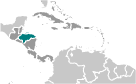
Map references
Central America and the Caribbean
Area World Ranking: 103
Total 112,090 sq km
Land 111,890 sq km Water 200 sq km Area - comparative
Slightly larger than Tennessee
Land boundaries
Total 1,520 km
Border countries Guatemala 256 km, El Salvador 342 km, Nicaragua 922 km Coastline
Caribbean Sea 669 km; Gulf of Fonseca 163 km Maritime claims
Territorial sea 12 nm
Contiguous zone 24 nm Exclusive economic zone 200 nm Continental shelf Natural extension of territory or to 200 nm Climate
Subtropical in lowlands, temperate in mountains Terrain
Mostly mountains in interior, narrow coastal plains Elevation extremes
Lowest point Caribbean Sea 0 m
Highest point Cerro Las Minas 2,870 m Natural resources
Timber, gold, silver, copper, lead, zinc, iron ore, antimony, coal, fish, hydropower Land use
Arable land 9.53%
Permanent crops 3.21% Other 87.26% (2005) Irrigated land
800 sq km (2003)
Total renewable water resources
95.9 cu km (2000)
Freshwater withdrawal (domestic/industrial/agricultural)
Total 0.86 cu km/yr (8%/12%/80%)
Per capita 119 cu m/yr (2000) Natural hazards
Frequent, but generally mild, earthquakes; extremely susceptible to damaging hurricanes and floods along the Caribbean coast Environment - current issues
Urban population expanding; deforestation results from logging and the clearing of land for agricultural purposes; further land degradation and soil erosion hastened by uncontrolled development and improper land use practices such as farming of marginal lands; mining activities polluting Lago de Yojoa (the country's largest source of fresh water), as well as several rivers and streams, with heavy metals Environment - international agreements
Party to
Biodiversity, Climate Change, Climate Change-Kyoto Protocol, Desertification, Endangered Species, Hazardous Wastes, Law of the Sea, Marine Dumping, Ozone Layer Protection, Ship Pollution, Tropical Timber 83, Tropical Timber 94, Wetlands Signed, but not ratified None of the selected agreements Geography - note
Has only a short Pacific coast but a long Caribbean shoreline, including the virtually uninhabited eastern Mosquito Coast
Comments
Add a new comment: |
Advertisement
Members area
Honduras (Tegucigalpa):
 
GPS points from Honduras (Tegucigalpa)
|
||||||||

 Once part of Spain's vast empire in the New World, Honduras became an independent nation in 1821. After two and a half decades of mostly military rule, a freely elected civilian government came to power in 1982. During the 1980s, Honduras proved a haven for anti-Sandinista contras fighting the Marxist Nicaraguan Government and an ally to Salvadoran Government forces fighting leftist guerrillas. The country was devastated by Hurricane Mitch in 1998, which killed about 5,600 people and caused approximately $2 billion in damage. Since then, the economy has slowly rebounded.