|
|
|
Advertisements:
TransportationAirports World Ranking: 107
39 (2012)
Airports - with paved runways
Total 16
Over 3,047 m 1 2,438 to 3,047 m 1 1,524 to 2,437 m 4 914 to 1,523 m 5 Under 914 m 5 (2012) Airports - with unpaved runways
Total 23
914 to 1,523 m 2 Under 914 m 21 (2012) Pipelines
Gas 1,888 km (2010)
Railways World Ranking: 54
Total 3,237 km
Broad gauge 1,872 km 1.600-m gauge (37 km electrified) Narrow gauge 1,365 km 0.914-m gauge (operated by the Irish Peat Board to transport peat to power stations and briquetting plants) (2008) Roadways World Ranking: 46
Total 96,036 km
Paved 96,036 km (includes 1,224 km of expressways) (2010) Waterways World Ranking: 68
956 km (pleasure craft only) (2010) Merchant marine World Ranking: 84
Total 31
By type Cargo 28, chemical tanker 2, container 1 Foreign-owned 5 (France 2, Spain 1, US 2)Registered in other countries 33 (Bahamas 3, Bermuda 1, Cambodia 1, Cyprus 3, Isle of Man 1, Kazakhstan 1, Malta 4, Marshall Islands 6, Netherlands 8, Panama 1, Russia 1, Slovakia 1, Sweden 1, UK 1) (2010) Ports and terminals
Cork, Dublin, Shannon Foynes, Waterford
Comments
Add a new comment: |
Advertisement
Members area
Ireland (Dublin):
 
GPS points from Ireland (Dublin)
|
||||||||

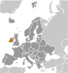 Celtic tribes arrived on the island between 600-150 B.C. Invasions by Norsemen that began in the late 8th century were finally ended when King Brian BORU defeated the Danes in 1014. English invasions began in the 12th century and set off more than seven centuries of Anglo-Irish struggle marked by fierce rebellions and harsh repressions. A failed 1916 Easter Monday Rebellion touched off several years of guerrilla warfare that in 1921 resulted in independence from the UK for 26 southern counties; six northern (Ulster) counties remained part of the UK. In 1949, Ireland withdrew from the British Commonwealth; it joined the European Community in 1973. Irish governments have sought the peaceful unification of Ireland and have cooperated with Britain against terrorist groups. A peace settlement for Northern Ireland is gradually being implemented despite some difficulties. In 2006, the Irish and British governments developed and began to implement the St. Andrews Agreement, building on the Good Friday Agreement approved in 1998.