|
|
|
Advertisements:
TransportationAirports World Ranking: 125
27 (2012)
Airports - with paved runways
Total 12
2,438 to 3,047 m 2 914 to 1,523 m 4 Under 914 m 6 (2012) Airports - with unpaved runways
Total 15
Under 914 m (2012) Roadways World Ranking: 107
Total
22,121 km (includes 44 km of expressways) (2005) Merchant marine World Ranking: 103
Total 14
By type Bulk carrier 4, cargo 5, container 4, roll on/roll off 1 Foreign-owned 14 (Denmark 1, Germany 10, Greece 3) (2010) Ports and terminals
Discovery Bay (Port Rhoades), Kingston, Montego Bay, Port Antonio, Port Esquivel, Port Kaiser, Rocky Point
Comments
Add a new comment: |
Advertisement
Members area
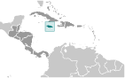
Jamaica (Kingston):
 
GPS points from Jamaica (Kingston)
|
||||||||

 The island - discovered by Christopher COLUMBUS in 1494 - was settled by the Spanish early in the 16th century. The native Taino Indians, who had inhabited Jamaica for centuries, were gradually exterminated and replaced by African slaves. England seized the island in 1655 and established a plantation economy based on sugar, cocoa, and coffee. The abolition of slavery in 1834 freed a quarter million slaves, many of whom became small farmers. Jamaica gradually increased its independence from Britain. In 1958 it joined other British Caribbean colonies in forming the Federation of the West Indies. Jamaica gained full independence when it withdrew from the Federation in 1962. Deteriorating economic conditions during the 1970s led to recurrent violence as rival gangs affiliated with the major political parties evolved into powerful organized crime networks involved in international drug smuggling and money laundering. Violent crime, drug trafficking, and poverty pose significant challenges to the government today. Nonetheless, many rural and resort areas remain relatively safe and contribute substantially to the economy.