|
|
|
Advertisements:
GeographyLocation
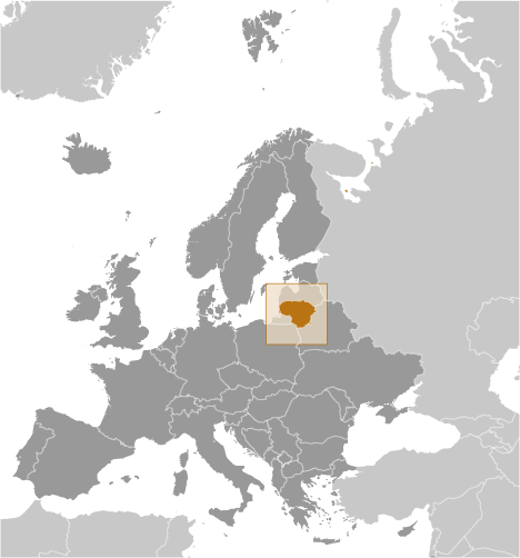
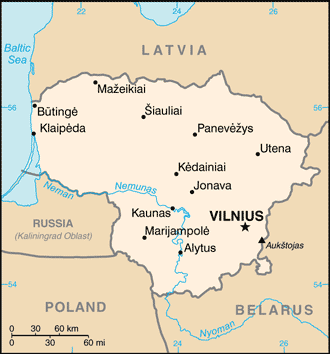
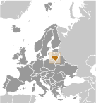
Eastern Europe, bordering the Baltic Sea, between Latvia and Russia Geographic coordinates
56 00 N, 24 00 E
Map references
Europe
Area World Ranking: 123
Total 65,300 sq km
Land 62,680 sq km Water 2,620 sq km Area - comparative
Slightly larger than West Virginia Land boundaries
Total 1,574 km
Border countries Belarus 680 km, Latvia 576 km, Poland 91 km, Russia (Kaliningrad) 227 km Coastline
90 km
Maritime claims
Territorial sea 12 nm
Climate
Transitional, between maritime and continental; wet, moderate winters and summers Terrain
Lowland, many scattered small lakes, fertile soil Elevation extremes
Lowest point Baltic Sea 0 m
Highest point Aukstojas 294 m Natural resources
Peat, arable land, amber
Land use
Arable land 44.81%
Permanent crops 0.9% Other 54.29% (2005) Irrigated land
13.4 sq km (2003)
Total renewable water resources
24.5 cu km (2005)
Freshwater withdrawal (domestic/industrial/agricultural)
Total 3.33 cu km/yr (78%/15%/7%)
Per capita 971 cu m/yr (2003) Natural hazards
NA
Environment - current issues
Contamination of soil and groundwater with petroleum products and chemicals at military bases Environment - international agreements
Party to
Air Pollution, Air Pollution-Nitrogen Oxides, Air Pollution-Persistent Organic Pollutants, Air Pollution-Sulphur 85, Air Pollution-Sulphur 94, Air Pollution-Volatile Organic Compounds, Biodiversity, Climate Change, Climate Change-Kyoto Protocol, Desertification, Endangered Species, Environmental Modification, Hazardous Wastes, Law of the Sea, Ozone Layer Protection, Ship Pollution, Wetlands Signed, but not ratified None of the selected agreements Geography - note
Fertile central plains are separated by hilly uplands that are ancient glacial deposits
Comments
Add a new comment: |
Advertisement
Members area
Lithuania (Vilnius):
GPS points from Lithuania (Vilnius)
|
||||||||
 Lithuanian lands were united under MINDAUGAS in 1236; over the next century, through alliances and conquest, Lithuania extended its territory to include most of present-day Belarus and Ukraine. By the end of the 14th century Lithuania was the largest state in Europe. An alliance with Poland in 1386 led the two countries into a union through the person of a common ruler. In 1569, Lithuania and Poland formally united into a single dual state, the Polish-Lithuanian Commonwealth. This entity survived until 1795 when its remnants were partitioned by surrounding countries. Lithuania regained its independence following World War I but was annexed by the USSR in 1940 - an action never recognized by the US and many other countries. On 11 March 1990, Lithuania became the first of the Soviet republics to declare its independence, but Moscow did not recognize this proclamation until September of 1991 (following the abortive coup in Moscow). The last Russian troops withdrew in 1993. Lithuania subsequently restructured its economy for integration into Western European institutions; it joined both NATO and the EU in the spring of 2004.