|
|
|
Advertisements:
TransportationAirports World Ranking: 135
21 (2012)
Airports - with paved runways
Total 8
2,438 to 3,047 m 5 1,524 to 2,437 m 2 914 to 1,523 m 1 (2012) Airports - with unpaved runways
Total 13
1,524 to 2,437 m 4 914 to 1,523 m 6 Under 914 m 3 (2012) Railways World Ranking: 109
Total 593 km
Narrow gauge 593 km 1.000-m gauge (2008) Roadways World Ranking: 114
Total 18,912 km
Paved 3,597 km Unpaved 15,315 km (2004) Waterways World Ranking: 44
1,800 km (downstream of Koulikoro; low water levels on the River Niger cause problems in dry years; in the months before the rainy season the river is not navigable by commercial vessels) (2011) Ports and terminals
Koulikoro
Comments
Add a new comment: |
Advertisement
Members area
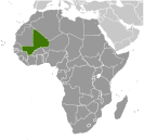
Mali (Bamako):
 
GPS points from Mali (Bamako)
|
||||||||

 The Sudanese Republic and Senegal became independent of France in 1960 as the Mali Federation. When Senegal withdrew after only a few months, what formerly made up the Sudanese Republic was renamed Mali. Rule by dictatorship was brought to a close in 1991 by a military coup that ushered in a period of democratic rule. President Alpha KONARE won Mali's first two democratic presidential elections in 1992 and 1997. In keeping with Mali's two-term constitutional limit, he stepped down in 2002 and was succeeded by Amadou TOURE, who was elected to a second term in 2007 elections that were widely judged to be free and fair.