|
|
|
Advertisements:
GeographyLocation
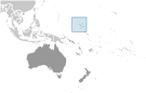
Oceania, two archipelagic island chains of 29 atolls, each made up of many small islets, and five single islands in the North Pacific Ocean, about half way between Hawaii and Australia Geographic coordinates
9 00 N, 168 00 E
Map references
Oceania
Area World Ranking: 216
Total 181 sq km
Land 181 sq km Water 0 sq km Note The archipelago includes 11,673 sq km of lagoon waters and includes the atolls of Bikini, Enewetak, Kwajalein, Majuro, Rongelap, and Utirik Area - comparative
About the size of Washington, DC Land boundaries
0 km
Coastline
370.4 km
Maritime claims
Territorial sea 12 nm
Contiguous zone 24 nm Exclusive economic zone 200 nm Climate
Tropical; hot and humid; wet season May to November; islands border typhoon belt Terrain
Low coral limestone and sand islands Elevation extremes
Lowest point Pacific Ocean 0 m
Highest point Unnamed location on Likiep 10 m Natural resources
Coconut products, marine products, deep seabed minerals Land use
Arable land 11.11%
Permanent crops 44.44% Other 44.45% (2005) Irrigated land
0 sq km
Natural hazards
Infrequent typhoons
Environment - current issues
Inadequate supplies of potable water; pollution of Majuro lagoon from household waste and discharges from fishing vessels Environment - international agreements
Party to
Biodiversity, Climate Change, Climate Change-Kyoto Protocol, Desertification, Hazardous Wastes, Law of the Sea, Ozone Layer Protection, Ship Pollution, Wetlands, Whaling Signed, but not ratified None of the selected agreements Geography - note
The islands of Bikini and Enewetak are former US nuclear test sites; Kwajalein atoll, famous as a World War II battleground, surrounds the world's largest lagoon and is used as a US missile test range; the island city of Ebeye is the second largest settlement in the Marshall Islands, after the capital of Majuro, and one of the most densely populated locations in the Pacific
Comments
Add a new comment: |
Advertisement
Members area
Marshall Islands (Majuro):
 
GPS points from Marshall Islands (Majuro)
|
||||||||

 After almost four decades under US administration as the easternmost part of the UN Trust Territory of the Pacific Islands, the Marshall Islands attained independence in 1986 under a Compact of Free Association. Compensation claims continue as a result of US nuclear testing on some of the atolls between 1947 and 1962. The Marshall Islands hosts the US Army Kwajalein Atoll (USAKA) Reagan Missile Test Site, a key installation in the US missile defense network.