|
|
|
Advertisements:
TransportationAirports World Ranking: 3
1,724 (2012)
Airports - with paved runways
Total 249
Over 3,047 m 12 2,438 to 3,047 m 30 1,524 to 2,437 m 82 914 to 1,523 m 88 Under 914 m 37 (2012) Airports - with unpaved runways
Total 1,475
Over 3,047 m 1 2,438 to 3,047 m 2 1,524 to 2,437 m 44 914 to 1,523 m 288 Under 914 m 1,140 (2012) Heliports
1 (2012)
Pipelines
Gas 16,594 km; liquid petroleum gas 2,152 km; oil 7,499 km; oil/gas/water 4 km; refined products 7,264 km; water 33 km (2010) Railways World Ranking: 16
Total 17,166 km
Standard gauge 17,166 km 1.435-m gauge (22 km electrified) (2008) Roadways World Ranking: 17
Total 366,095 km
Paved 132,289 km (includes 6,279 km of expressways) Unpaved 233,806 km (2008)Waterways World Ranking: 34
2,900 km (navigable rivers and coastal canals mostly connected with ports on the country's east coast) (2012) Merchant marine World Ranking: 70
Total 52
By type Bulk carrier 5, cargo 3, chemical tanker 11, liquefied gas 3, passenger/cargo 10, petroleum tanker 17, roll on/roll off 3 Foreign-owned 5 (France 1, Greece 2, South Africa 1, UAE 1) Registered in other countries 12 (Antigua and Barbuda 1, Marshall Islands 2, Panama 5, Portugal 1, Spain 1, Venezuela 1, unknown 1) (2010) Ports and terminals
Altamira, Coatzacoalcos, Lazaro Cardenas, Manzanillo, Salina Cruz, Veracruz Oil terminals Cayo Arcas terminal, Dos Bocas terminal
Comments
Add a new comment: |
Advertisement
Members area
Mexico (Mexico City):
 
GPS points from Mexico (Mexico City)
|
||||||||

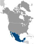 The site of advanced Amerindian civilizations - including the Olmec, Toltec, Teotihuacan, Zapotec, Maya, and Aztec - Mexico was conquered and colonized by Spain in the early 16th century. Administered as the Viceroyalty of New Spain for three centuries, it achieved its independence early in the 19th century. The global financial crisis beginning in late 2008 caused a massive economic downturn the following year, although growth returned quickly in 2010. Ongoing economic and social concerns include low real wages, underemployment for a large segment of the population, inequitable income distribution, and few advancement opportunities for the largely Amerindian population in the impoverished southern states. The elections held in 2000 marked the first time since the 1910 Mexican Revolution that an opposition candidate - Vicente FOX of the National Action Party (PAN) - defeated the party in government, the Institutional Revolutionary Party (PRI). He was succeeded in 2006 by another PAN candidate Felipe CALDERON. National elections, including the presidential election, are scheduled for 1 July 2012. Since 2007, Mexico's powerful drug-trafficking organizations have engaged in bloody feuding, resulting in tens of thousands of drug-related homicides.