|
|
|
Advertisements:
TransportationAirports World Ranking: 143
16 (2012)
Airports - with paved runways
Total 7
Over 3,047 m 1 2,438 to 3,047 m 1 1,524 to 2,437 m 1 914 to 1,523 m 3 Under 914 m 1 (2012) Airports - with unpaved runways
Total 9
1,524 to 2,437 m 1 914 to 1,523 m 3 Under 914 m 5 (2012) Pipelines
Gas 840 km; oil 5 km (2010)
Railways World Ranking: 83
Total 1,228 km
Standard gauge 1,228 km 1.435-m gauge (503 km electrified) (2007) Roadways World Ranking: 92
Total 38,925 km
Paved 38,925 km (includes 658 km of expressways) (2008) Waterways
(there is some transport on the Drava River) (2012) Merchant marine World Ranking: 90
Registered in other countries
24 (Cyprus 5, Liberia 7, Malta 4, Marshall Islands 6, Saint Vincent and the Grenadines 1, Slovakia 1) (2010) Ports and terminals
Koper
Comments
Add a new comment: |
Advertisement
Members area
Slovenia (Ljubljana):
 
GPS points from Slovenia (Ljubljana)
|
||||||||

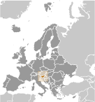 The Slovene lands were part of the Austro-Hungarian Empire until the latter's dissolution at the end of World War I. In 1918, the Slovenes joined the Serbs and Croats in forming a new multinational state, which was named Yugoslavia in 1929. After World War II, Slovenia became a republic of the renewed Yugoslavia, which though Communist, distanced itself from Moscow's rule. Dissatisfied with the exercise of power by the majority Serbs, the Slovenes succeeded in establishing their independence in 1991 after a short 10-day war. Historical ties to Western Europe, a strong economy, and a stable democracy have assisted in Slovenia's transformation to a modern state. Slovenia acceded to both NATO and the EU in the spring of 2004; it joined the eurozone in 2007.