|
|
|
Advertisements:
GeographyLocation
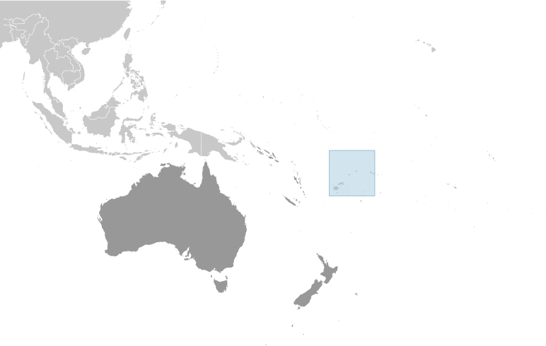
Oceania, islands in the South Pacific Ocean, about two-thirds of the way from Hawaii to New Zealand Geographic coordinates
13 18 S, 176 12 W
Map references
Oceania
Area World Ranking: 220
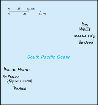
Total 142 sq km
Land 142 sq km Water 0 sq km Note Includes Ile Uvea (Wallis Island), Ile Futuna (Futuna Island), Ile Alofi, and 20 islets Area - comparative
1.5 times the size of Washington, DC Land boundaries
0 km
Coastline
129 km
Maritime claims
Territorial sea 12 nm
Exclusive economic zone 200 nm Climate
Tropical; hot, rainy season (November to April); cool, dry season (May to October); rains 2,500-3,000 mm per year (80% humidity); average temperature 26.6 degrees C Terrain
Volcanic origin; low hills
Elevation extremes
Lowest point Pacific Ocean 0 m
Highest point Mont Singavi (on Futuna) 765 m Natural resources
NEGL
Land use
Arable land 7.14%
Permanent crops 35.71% Other 57.15% (2005) Irrigated land
NA
Natural hazards
NA
Environment - current issues
Deforestation (only small portions of the original forests remain) largely as a result of the continued use of wood as the main fuel source; as a consequence of cutting down the forests, the mountainous terrain of Futuna is particularly prone to erosion; there are no permanent settlements on Alofi because of the lack of natural freshwater resources Geography - note
Both island groups have fringing reefs
Comments
Add a new comment: |
Advertisement
Members area
Wallis And Futuna [ France ] (Overseas Territory):
GPS points from Wallis And Futuna [ France ] (Overseas Territory)
|
||||||||
 The Futuna island group was discovered by the Dutch in 1616 and Wallis by the British in 1767, but it was the French who declared a protectorate over the islands in 1842, and took official control of them between 1886 and 1888. Notably, Wallis and Futuna was the only French colony to side with the Vichy regime during World War II, a phase that ended in May of 1942 with the arrival of 2,000 American troops. In 1959, the inhabitants of the islands voted to become a French overseas territory and officially assumed this status in July 1961.