13°15'0" N
105°45'0" E
~143m asl
14:49 (ICT - UTC/GMT+7)
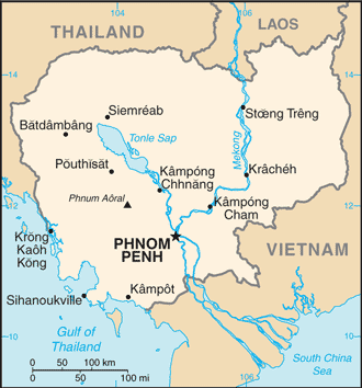
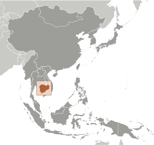
Srok Siembauk (Srok Siembauk) is a administrative division (class A - Administrative Region) in Khett Stoeng Treng (St?ng Trêng), Cambodia (Asia) with the region font code of Asia/Pacific. It is located at an elevation of 143 meters above sea level.
Srok Siembauk is also known as Srok Siem Boak, Srok Siembaok, Srok Siembauk, Srok Siembok, Srŏk Siĕmbok.
Its coordinates are 13°15'0" N and 105°45'0" E in DMS (Degrees Minutes Seconds) or 13.25 and 105.75 (in decimal degrees). Its UTM position is WV86 and its Joint Operation Graphics reference is ND48-11.
Current local time is 14:49; the sun rises at 08:54 and sets at 21:01 local time (Asia/Phnom_Penh UTC/GMT+7). The standard time zone for Srok Siembauk is UTC/GMT+7
In 2024 DST starts on - and ends on -.
A Administrative division is an administrative division of a country, undifferentiated as to administrative level.
|
Advertisements:
Advertisements:
|
Weather Srok Siembauk (Cloud cover, Temperature, Wind speed and Precipitation mm probab.)
Fri
Apr 26
35 °C min
43 °C max
9 km/h
Thu Jan 1
|
Sat
Apr 27
~1 l/m2 12%
27 °C min
43 °C max
12 km/h
Thu Jan 1
|
Sun
Apr 28
~3 l/m2 46%
27 °C min
41 °C max
11 km/h
Thu Jan 1
|
Mon
Apr 29
~1 l/m2 20%
26 °C min
42 °C max
13 km/h
Thu Jan 1
|
Tue
Apr 30
~0.4 l/m2 13%
27 °C min
42 °C max
12 km/h
Thu Jan 1
|
Wed
May 1
~1 l/m2 27%
28 °C min
42 °C max
10 km/h
Thu Jan 1
|
|
|
Srok Siembok (Khett Stoeng Treng) 7 day forecast
Map and Photos Srok Siembauk
--- There are no comments yet ---
Add a new comment:
|
Advertisement
Members area
Cambodia (Phnom Penh):
GPS points from Cambodia (Phnom Penh)
|