|
|
|
A-tang-chai
Weather A-tang-chai (Cloud cover, Temperature, Wind speed and Precipitation mm probab.)
Map and Photos A-tang-chai
Comments
Add a new comment: |
Members area
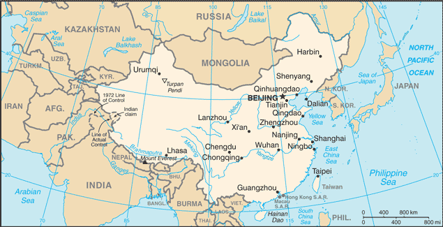
China (Beijing):
Advertisement
GPS points near A-tang-chai
 Adang (0.5km)
A-tang (0.5km)
A-tang-chai (0.5km)
Guan'gisyaoshuy (3 km)
Hulu He (3 km)
Hu-lu Ho (3 km)
Tz'u Ho (3 km)
Daxian (4 km)
Chiao-ho-k'ou (7 km)
Chiao-k'ou-ho (7 km)
Jiaohekou (7 km)
Longshou (8 km)
Lung-shou (8 km)
Ju He (8 km)
Yuni He (8 km)
Longfang (9 km)
Longfangjie (9 km)
Adang (0.5km)
A-tang (0.5km)
A-tang-chai (0.5km)
Guan'gisyaoshuy (3 km)
Hulu He (3 km)
Hu-lu Ho (3 km)
Tz'u Ho (3 km)
Daxian (4 km)
Chiao-ho-k'ou (7 km)
Chiao-k'ou-ho (7 km)
Jiaohekou (7 km)
Longshou (8 km)
Lung-shou (8 km)
Ju He (8 km)
Yuni He (8 km)
Longfang (9 km)
Longfangjie (9 km)
GPS points from China (Beijing)
|