English   Română   Español   Français   Deutsch  

getamap.net

Africa

Oceania

Asia

North America

Europe

South America

Antarctica


Port Saint Mary Bay


54°4'0" N
4°43'60" W
11:21 (BST - UTC/GMT+1)

Port Saint Mary Bay (Port Saint Mary Bay) is a bay (class H - Hydrographic) in (Isle of Man (general)), Isle Of Man [ United Kingdom ] (Europe) with the region font code of Americas/Western Europe.

Its coordinates are 54°4'0" N and 4°43'60" W in DMS (Degrees Minutes Seconds) or 54.0667 and -4.73333 (in decimal degrees). Its UTM position is UE89 and its Joint Operation Graphics reference is NN30-04.

Current local time is 11:21; the sun rises at 07:54 and sets at 20:01 local time (Europe/Isle_of_Man UTC/GMT+1). The standard time zone for Port Saint Mary Bay is UTC/GMT+0, but since Daylight Saving Time (DST) is in effect the current time zone is UTC/GMT+1.
In 2024 DST starts on 31 Mar 2024 and ends on 27 Oct 2024.

A Bay is a coastal indentation between two capes or headlands, larger than a cove but smaller than a gulf.


Country
 Advertisements:


 Advertisements:


Weather Port Saint Mary Bay (Cloud cover, Temperature, Wind speed and Precipitation mm probab.)

Fri


Apr 26
Clound 0-10-20-20
 
6 °C min
9 °C max
17 km/h
Thu Jan 1

Sat


Apr 27
Clound 20-40-30-10 Mist
~4 l/m2 58%
 
7 °C min
9 °C max
24 km/h
Thu Jan 1

Sun


Apr 28
Clound 0-20-10-20
 
6 °C min
10 °C max
30 km/h
Thu Jan 1

Mon


Apr 29
Clound 20-80-80-10
~3 l/m2 60%
 
9 °C min
11 °C max
40 km/h
Thu Jan 1

Tue


Apr 30
Clound 10-100-100-80 Mist
~12 l/m2 77%
 
9 °C min
11 °C max
43 km/h
Thu Jan 1

Wed


May 1
Clound 10-60-70-70
~2 l/m2 57%
 
10 °C min
13 °C max
30 km/h
Thu Jan 1

Weather Graph

Map and Photos Port Saint Mary Bay


Comments

--- There are no comments yet ---


Add a new comment:


You have to log in to add a comment!


Members area


Register

Forgot password?

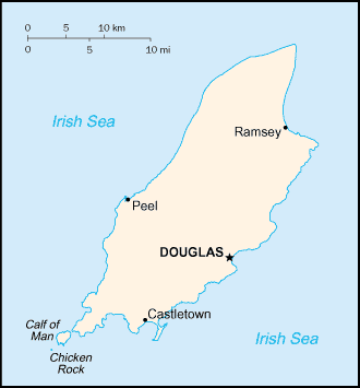
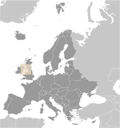
Isle Of Man [ United Kingdom ] (British Crown Dependency):

Advertisement


GPS points near Port Saint Mary Bay


square Naggin Head (1 km)

square Nogging Head (1 km)

square Noggin Head (1 km)

square Perwick Bay (1 km)

square Cregneish (2 km)

square Spanish Head (2 km)

square Wart Bank (2 km)

square Colby (3 km)

square Bradda Head (4 km)

square Scarlet Point (4 km)

square Calf Sound (4 km)

square Ballabeg (4 km)

square Port Erin (4 km)

square Fleshwick Bay (5 km)

square Castletown (5 km)


GPS points from Isle Of Man [ United Kingdom ] (British Crown Dependency)

square Scarlet Point Isle Of Man

square River Glass Isle Of Man

square Douglas Bay Isle Of Man

square Crosby Isle Of Man

square Saint Maughold Isle Of Man (general)

square The Ayre Isle Of Man

square Tynwald Hill Isle Of Man

square Strunakill Bank Isle Of Man


viewweather.com sv.ViewWeather.com
fr.ViewWeather.com
da.ViewWeather.com
de.ViewWeather.com
es.ViewWeather.com
www.carpati.org
www.searchromania.net
Deblocari usi
es.getamap.org
fr.getamap.org
de.getamap.org
nl.getamap.org
da.getamap.org
www.getamap.org
Links
Terms of use
Privacy policy

# 0.0630 sec 

contact AT getamap.net

© 2006 - 2024  https://www.getamap.net/