English   Română   Español   Français   Deutsch  

getamap.net

Africa

Oceania

Asia

North America

Europe

South America

Antarctica


Pakruojo Rajonas

/ Siauliu Apskritis

55°58'0" N
23°52'0" E
~76m asl
12:04 (EEST - UTC/GMT+3)

Pakruojo Rajonas (Pakruojo Rajonas) is a second-order administrative division (class A - Administrative Region) in Siauliu Apskritis (Šiauliu Apskritis), Lithuania (Europe) with the region font code of Eastern Europe. It is located at an elevation of 76 meters above sea level.

Its coordinates are 55°58'0" N and 23°52'0" E in DMS (Degrees Minutes Seconds) or 55.9667 and 23.8667 (in decimal degrees). Its UTM position is FH70 and its Joint Operation Graphics reference is NN34-03.

Current local time is 12:04; the sun rises at 07:53 and sets at 20:00 local time (Europe/Vilnius UTC/GMT+3). The standard time zone for Pakruojo Rajonas is UTC/GMT+2, but since Daylight Saving Time (DST) is in effect the current time zone is UTC/GMT+3.
In 2024 DST starts on 31 Mar 2024 and ends on 27 Oct 2024.

A Second-order administrative division is a subdivision of a first-order administrative division.


Country
 Advertisements:


 Advertisements:


Weather Pakruojo Rajonas (Cloud cover, Temperature, Wind speed and Precipitation mm probab.)

Mon


Apr 29
Clound 0-10-70-100
 
9 °C min
21 °C max
28 km/h
Thu Jan 1

Tue


Apr 30
Clound 0-50-70-90
 
13 °C min
20 °C max
18 km/h
Thu Jan 1

Wed


May 1
Clound 0-0-30-100
 
10 °C min
21 °C max
14 km/h
Thu Jan 1

Thu


May 2
Clound 10-20-0-60
 
9 °C min
21 °C max
15 km/h
Thu Jan 1

Fri


May 3
Clound 0-50-10-10
 
9 °C min
22 °C max
15 km/h
Thu Jan 1

Sat


May 4
Clound 0-80-20-50 Lightning
 
14 °C min
23 °C max
18 km/h
Thu Jan 1

Weather Graph

Pakruojo Rajonas (Siauliu Apskritis) 7 day forecast
 

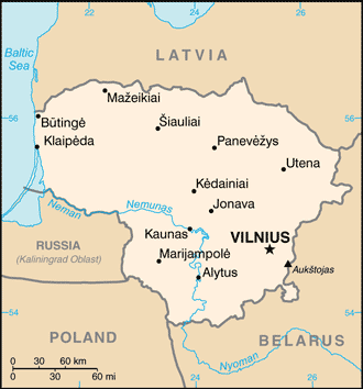
Map and Photos Pakruojo Rajonas


Comments

--- There are no comments yet ---


Add a new comment:


You have to log in to add a comment!


Members area


Register

Forgot password?

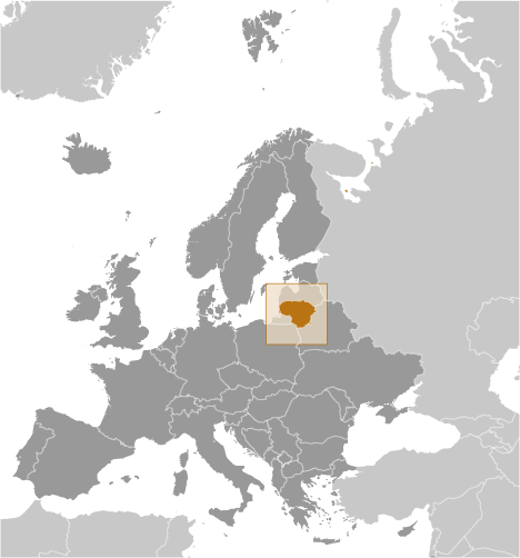
Lithuania (Vilnius):

Advertisement


GPS points near Pakruojo Rajonas

square Jovarai (2 km)

square Naujadvaris (2 km)

square Nauyas Dvaras (2 km)

square Pasiliai (2 km)

square Pasilis (2 km)

square Beshenay (2 km)

square Besoniai (2 km)

square Nereikoniai (2 km)

square Nereikoniu (2 km)

square Nereikonys (2 km)

square Nereykonyay (2 km)


square Karashelyay (3 km)

square Karasilis (3 km)

square Mazeikoniai (3 km)

square Mazheykenay (3 km)

square Mazheykonay (3 km)


GPS points from Lithuania (Vilnius)

square Mijaugonio Vilniaus Apskritis

square Menkupiai Marijampoles Apskritis

square Sates Telsiu Apskritis

square Sherkshnenay Telsiu Apskritis

square Valkininkas Vilniaus Apskritis

square Tovtvilyay Telsiu Apskritis

square Berstininkai Taurages Apskritis

square Berzhininkay Siauliu Apskritis


viewweather.com sv.ViewWeather.com
fr.ViewWeather.com
da.ViewWeather.com
de.ViewWeather.com
es.ViewWeather.com
www.carpati.org
www.searchromania.net
Deblocari usi
es.getamap.org
fr.getamap.org
de.getamap.org
nl.getamap.org
da.getamap.org
www.getamap.org
Links
Terms of use
Privacy policy

# 0.0750 sec 

contact AT getamap.net

© 2006 - 2024  https://www.getamap.net/