55°29'16" N
21°7'7" E
~0m asl
14:02 (EEST - UTC/GMT+3)
Agilos Ragas (Agilos Ragas) is a point (class T - Hypsographic) in Lithuania (general), Lithuania (Europe) with the region font code of Eastern Europe...
Agilos Ragas is also known as Agilos Ragas, Mys Agilos, Mys Neegel'nsher, Mys Neegel’nsher, Mys Negel'nsher-Khaken, Mys Negel’nsher-Khaken, Neegelnscherhaken.
Its coordinates are 55°29'16" N and 21°7'7" E in DMS (Degrees Minutes Seconds) or 55.4878 and 21.1186 (in decimal degrees). Its UTM position is EG04 and its Joint Operation Graphics reference is NN34-02.
Current local time is 14:02; the sun rises at 07:53 and sets at 20:00 local time (Europe/Vilnius UTC/GMT+3). The standard time zone for Agilos Ragas is UTC/GMT+2, but since Daylight Saving Time (DST) is in effect the current time zone is UTC/GMT+3.
In 2024 DST starts on 31 Mar 2024 and ends on 27 Oct 2024.
A Point is a tapering piece of land projecting into a body of water, less prominent than a cape.
|
Advertisements:
Advertisements:
|
Weather Agilos Ragas (Cloud cover, Temperature, Wind speed and Precipitation mm probab.)
Sun
Apr 28
7 °C min
14 °C max
23 km/h
Thu Jan 1
|
Mon
Apr 29
9 °C min
14 °C max
29 km/h
Thu Jan 1
|
Tue
Apr 30
10 °C min
14 °C max
28 km/h
Thu Jan 1
|
Wed
May 1
9 °C min
16 °C max
22 km/h
Thu Jan 1
|
Thu
May 2
9 °C min
14 °C max
18 km/h
Thu Jan 1
|
Fri
May 3
10 °C min
13 °C max
15 km/h
Thu Jan 1
|
|
|
Agilos Ragas (Lithuania (general)) 7 day forecast
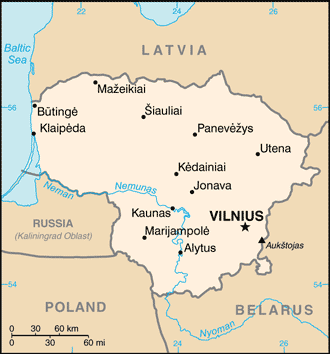
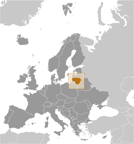
Map and Photos Agilos Ragas
--- There are no comments yet ---
Add a new comment:
|
Members area
Lithuania (Vilnius):
Advertisement
GPS points near Agilos Ragas
GPS points from Lithuania (Vilnius)
 Salnu Panevezio Apskritis
Uta Taurages Apskritis
|