English   Română   Español   Français   Deutsch  

getamap.net

Africa

Oceania

Asia

North America

Europe

South America

Antarctica


Le Barachois


46°46'27" N
56°10'34" W
14:11 (PMDT - UTC/GMT--2)

Le Barachois (Le Barachois) is a harbor(s) (class H - Hydrographic) in (Saint Pierre and Miquelon (general)), Saint Pierre And Miquelon [ France ] (North America) with the region font code of Americas/Western Europe.

Its coordinates are 46°46'27" N and 56°10'34" W in DMS (Degrees Minutes Seconds) or 46.7742 and -56.1761 (in decimal degrees). Its UTM position is WM68 and its Joint Operation Graphics reference is NL21-02.

Current local time is 14:11; the sun rises at 07:54 and sets at 20:01 local time (America/Miquelon UTC/GMT-2). The standard time zone for Le Barachois is UTC/GMT-3, but since Daylight Saving Time (DST) is in effect the current time zone is UTC/GMT-2.
In 2024 DST starts on 10 Mar 2024 and ends on 3 Nov 2024.

A Harbor(s) is a haven or space of deep water so sheltered by the adjacent land as to afford a safe anchorage for ships.


Country
 Advertisements:


 Advertisements:


Weather Le Barachois (Cloud cover, Temperature, Wind speed and Precipitation mm probab.)

Fri


Apr 26
Clound 0-20-10-30
 
1 °C min
2 °C max
25 km/h
Thu Jan 1

Sat


Apr 27
Clound 0-10-20-10
 
-1 °C min
3 °C max
28 km/h
Thu Jan 1

Sun


Apr 28
Clound 0-40-50-40
~1 l/m2 54%
 
0 °C min
5 °C max
41 km/h
Thu Jan 1

Mon


Apr 29
Clound 0-100-40-70 Mist
~10 l/m2 81%
 
2 °C min
5 °C max
46 km/h
Thu Jan 1

Tue


Apr 30
Clound 0-100-60-50 Mist
~9 l/m2 71%
 
2 °C min
5 °C max
46 km/h
Thu Jan 1

Wed


May 1
Clound 0-100-70-40 Mist
~5 l/m2 65%
 
2 °C min
5 °C max
47 km/h
Thu Jan 1

Weather Graph

Map and Photos Le Barachois


Comments

--- There are no comments yet ---


Add a new comment:


You have to log in to add a comment!


Members area


Register

Forgot password?

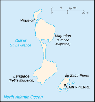
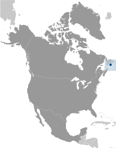
Saint Pierre And Miquelon [ France ] (Overseas Territory):

Advertisement


GPS points near Le Barachois

GPS points from Saint Pierre And Miquelon [ France ] (Overseas Territory)

square Cap Corbeau Saint Pierre And Miquelon (general)

square Petit Saint-pierre Saint Pierre And Miquelon (general)

square Commune De Miquelon-langlade Saint Pierre And Miquelon (general)

square Etang De Savoyard Saint Pierre And Miquelon (general)

square Collectivite Territoriale De Saint-pierre Et Miquelon Saint Pierre And Miquelon (general)

square Anse A Couillette Saint Pierre And Miquelon (general)

square Basse Bataille Saint Pierre And Miquelon (general)

square Marais De L' Anse A Henry Saint Pierre And Miquelon (general)


viewweather.com sv.ViewWeather.com
fr.ViewWeather.com
da.ViewWeather.com
de.ViewWeather.com
es.ViewWeather.com
www.carpati.org
www.searchromania.net
Deblocari usi
es.getamap.org
fr.getamap.org
de.getamap.org
nl.getamap.org
da.getamap.org
www.getamap.org
Links
Terms of use
Privacy policy

# 0.0619 sec 

contact AT getamap.net

© 2006 - 2024  https://www.getamap.net/