English   Română   Español   Français   Deutsch  

getamap.net

Africa

Oceania

Asia

North America

Europe

South America

Antarctica


Mount Harrison

/ Seychelles (general)

4°40'60" S
55°28'60" E
~566m asl
22:31 (SCT - UTC/GMT+4)

Mount Harrison (Mount Harrison) is a peak (class T - Hypsographic) in Seychelles (general), Seychelles (Africa) with the region font code of Americas/Western Europe. It is located at an elevation of 566 meters above sea level.

Its coordinates are 4°40'60" S and 55°28'60" E in DMS (Degrees Minutes Seconds) or -4.68333 and 55.4833 (in decimal degrees). Its UTM position is CV38 and its Joint Operation Graphics reference is SB40-01.

Current local time is 22:31; the sun rises at 08:54 and sets at 21:01 local time (Indian/Mahe UTC/GMT+4). The standard time zone for Mount Harrison is UTC/GMT+4
In 2024 DST starts on - and ends on -.

A Peak is a pointed elevation atop a mountain, ridge, or other hypsographic feature.


Country
 Advertisements:


 Advertisements:


Weather Mount Harrison (Cloud cover, Temperature, Wind speed and Precipitation mm probab.)

Fri


Apr 26
Clound 50-20-20-100
~2 l/m2 42%
 
28 °C min
29 °C max
11 km/h
Thu Jan 1

Sat


Apr 27
Clound 30-0-10-100 Lightning
~18 l/m2 80%
 
28 °C min
30 °C max
10 km/h
Thu Jan 1

Sun


Apr 28
Clound 30-0-60-100 Lightning
~15 l/m2 72%
 
28 °C min
29 °C max
28 km/h
Thu Jan 1

Mon


Apr 29
Clound 60-30-90-100 Mist Lightning
~49 l/m2 93%
 
27 °C min
29 °C max
37 km/h
Thu Jan 1

Tue


Apr 30
Clound 10-30-100-50 Mist Lightning
~7 l/m2 69%
 
27 °C min
29 °C max
23 km/h
Thu Jan 1

Wed


May 1
Clound 10-10-50-60 Lightning
~2 l/m2 47%
 
28 °C min
30 °C max
23 km/h
Thu Jan 1

Weather Graph

Mount Harrison (Seychelles (general)) 7 day forecast
 

Map and Photos Mount Harrison


Comments

--- There are no comments yet ---


Add a new comment:


You have to log in to add a comment!


Members area


Register

Forgot password?

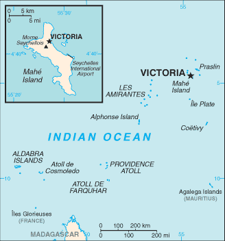
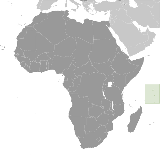
Seychelles (Victoria):

Advertisement


GPS points near Mount Harrison

square Bayonne (1 km)


square Mount Sebert (1 km)

square Cascade (1 km)

square Baillon River (1 km)

square Anse Boileau (1 km)

square Caiman River (1 km)

square Inner Islands (2 km)

square La Digue (2 km)

square La Misere (2 km)

square Mahe (2 km)

square Mahe Island (2 km)

square Misere (2 km)


square Dupuy River (2 km)

square Gaspard (2 km)

square Anse Polite (2 km)


GPS points from Seychelles (Victoria)

square Poivre Islets Seychelles (general)

square Chevalier Point Seychelles (general)

square Machabee Beau Vallon

square Round Islet Seychelles (general)

square Takamaka Beau Vallon

square Anse Mare Jupe Seychelles (general)

square Caiman River Seychelles (general)

square Les Amirantes Seychelles (general)


viewweather.com sv.ViewWeather.com
fr.ViewWeather.com
da.ViewWeather.com
de.ViewWeather.com
es.ViewWeather.com
www.carpati.org
www.searchromania.net
Deblocari usi
es.getamap.org
fr.getamap.org
de.getamap.org
nl.getamap.org
da.getamap.org
www.getamap.org
Links
Terms of use
Privacy policy

# 0.0656 sec 

contact AT getamap.net

© 2006 - 2024  https://www.getamap.net/