English   Română   Español   Français   Deutsch  

getamap.net

Africa

Oceania

Asia

North America

Europe

South America

Antarctica


Souris Island

/ Beau Vallon

4°43'60" S
55°31'0" E
~0m asl
17:47 (SCT - UTC/GMT+4)

Souris Island (Souris Island) is a island (class T - Hypsographic) in Beau Vallon (Seychelles (general)), Seychelles (Africa) with the region font code of Americas/Western Europe.. and its population amounts to 539.
Souris Island is also known as Souris Island, Souris islet.

Its coordinates are 4°43'60" S and 55°31'0" E in DMS (Degrees Minutes Seconds) or -4.73333 and 55.5167 (in decimal degrees). Its UTM position is CV37 and its Joint Operation Graphics reference is SB40-01.

Current local time is 17:47; the sun rises at 08:53 and sets at 21:00 local time (Indian/Mahe UTC/GMT+4). The standard time zone for Souris Island is UTC/GMT+4
In 2024 DST starts on - and ends on -.

A Island is a tract of land, smaller than a continent, surrounded by water at high water.


Country
 Advertisements:


 Advertisements:


Weather Souris Island (Cloud cover, Temperature, Wind speed and Precipitation mm probab.)

Sun


Apr 28
Clound 10-10-100-60 Lightning
~1 l/m2 51%
 
29 °C min
30 °C max
17 km/h
Thu Jan 1

Mon


Apr 29
Clound 50-30-100-60 Lightning
~29 l/m2 93%
 
27 °C min
30 °C max
25 km/h
Thu Jan 1

Tue


Apr 30
Clound 10-20-50-40 Lightning
~5 l/m2 57%
 
28 °C min
29 °C max
10 km/h
Thu Jan 1

Wed


May 1
Clound 0-10-60-10 Lightning
~4 l/m2 62%
 
28 °C min
30 °C max
19 km/h
Thu Jan 1

Thu


May 2
Clound 0-10-20-60 Lightning
~1 l/m2 25%
 
28 °C min
30 °C max
22 km/h
Thu Jan 1

Fri


May 3
Clound 20-0-0-40
~2 l/m2 20%
 
29 °C min
30 °C max
19 km/h
Thu Jan 1

Weather Graph

Souris Island (Beau Vallon) 7 day forecast
 

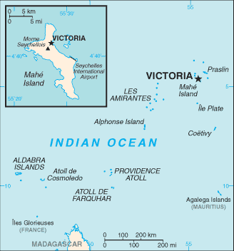
Map and Photos Souris Island


Comments

--- There are no comments yet ---


Add a new comment:


You have to log in to add a comment!


Members area


Register

Forgot password?

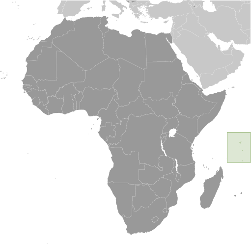
Seychelles (Victoria):

Advertisement


GPS points near Souris Island

square Anse Royale (0.5km)

square Point au Sel (1 km)

square Sel Point (1 km)


square Mon Plaisir (1 km)

square Saint-Antoine (1 km)

square Castle Peak (1 km)


square Le Cap (1 km)

square Anse Baleine (1 km)

square L'Enponcement (1 km)

square Royale (1 km)


square Du Cap River (2 km)


square Au Cap (3 km)


GPS points from Seychelles (Victoria)

square Long Islet Seychelles (general)

square Petite Police Seychelles (general)

square La Digue Island Inner Islands

square Conception Island Seychelles (general)

square Baie Lazare Baie Lazare

square Shark Rock Seychelles (general)

square Poule Islet Seychelles (general)

square Saint Pierre Island Seychelles (general)


viewweather.com sv.ViewWeather.com
fr.ViewWeather.com
da.ViewWeather.com
de.ViewWeather.com
es.ViewWeather.com
www.carpati.org
www.searchromania.net
Deblocari usi
es.getamap.org
fr.getamap.org
de.getamap.org
nl.getamap.org
da.getamap.org
www.getamap.org
Links
Terms of use
Privacy policy

# 0.0786 sec 

contact AT getamap.net

© 2006 - 2024  https://www.getamap.net/