23°22'60" N
13°7'0" W
~364m asl
09:11 (WET - UTC/GMT+0)
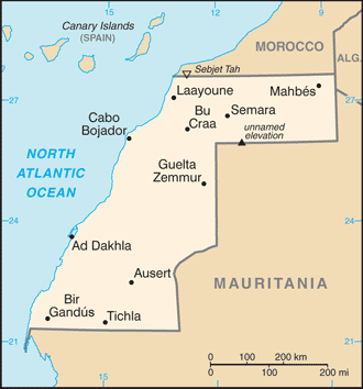
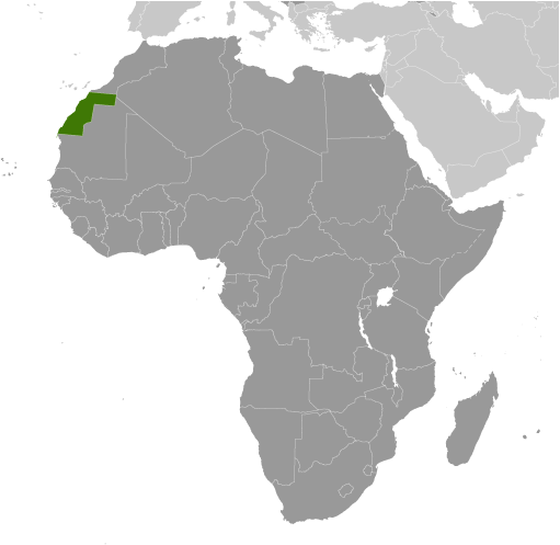
Gleibat el Barca (Gleibat el Barca) is a hill (class T - Hypsographic) in Western Sahara (general), Western Sahara [ Undetermined ] (Africa) with the region font code of Africa/Middle East. It is located at an elevation of 364 meters above sea level.
Gleibat el Barca is also known as Cap Barbas, Gleib el Barka, Gleibat el Barca, Gleibat el Barka.
Its coordinates are 23°22'60" N and 13°7'0" W in DMS (Degrees Minutes Seconds) or 23.3833 and -13.1167 (in decimal degrees). Its UTM position is FL98 and its Joint Operation Graphics reference is NF28-04.
Current local time is 09:11; the sun rises at 08:54 and sets at 21:01 local time (Africa/El_Aaiun UTC/GMT+0). The standard time zone for Gleibat el Barca is UTC/GMT+0
In 2024 DST starts on - and ends on -.
A Hill is a rounded elevation of limited extent rising above the surrounding land with local relief of less than 300m.
|
Advertisements:
Advertisements:
|
Weather Gleibat el Barca (Cloud cover, Temperature, Wind speed and Precipitation mm probab.)
Fri
Apr 26
~3 l/m2 53%
23 °C min
31 °C max
41 km/h
Thu Jan 1
|
Sat
Apr 27
20 °C min
30 °C max
20 km/h
Thu Jan 1
|
Sun
Apr 28
16 °C min
29 °C max
27 km/h
Thu Jan 1
|
Mon
Apr 29
14 °C min
28 °C max
34 km/h
Thu Jan 1
|
Tue
Apr 30
14 °C min
28 °C max
32 km/h
Thu Jan 1
|
Wed
May 1
14 °C min
31 °C max
30 km/h
Thu Jan 1
|
|
|
Gleibat el Barca (Western Sahara (general)) 7 day forecast
Map and Photos Gleibat el Barca
--- There are no comments yet ---
Add a new comment:
|
Members area
Western Sahara [ Undetermined ] (El Aaiun):
Advertisement
GPS points near Gleibat el Barca
GPS points from Western Sahara [ Undetermined ] (El Aaiun)
 Chelua Western Sahara (general)
|