21°20'56" N
15°45'45" W
~268m asl
02:32 (WET - UTC/GMT+0)
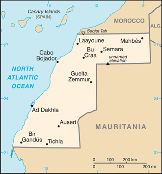
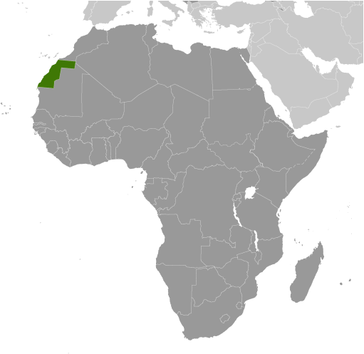
Lagwiyer Labyad (Lagwiyer Labyad) is a hill (class T - Hypsographic) in Western Sahara (general), Western Sahara [ Undetermined ] (Africa) with the region font code of Africa/Middle East. It is located at an elevation of 268 meters above sea level.
Lagwiyer Labyad is also known as Lagwiyer Labyad, Legueir Labiad, Legüeir Labiad.
Its coordinates are 21°20'56" N and 15°45'45" W in DMS (Degrees Minutes Seconds) or 21.3489 and -15.7625 (in decimal degrees). Its UTM position is DJ26 and its Joint Operation Graphics reference is NF28-10.
Current local time is 02:32; the sun rises at 08:54 and sets at 21:01 local time (Africa/El_Aaiun UTC/GMT+0). The standard time zone for Lagwiyer Labyad is UTC/GMT+0
In 2024 DST starts on - and ends on -.
A Hill is a rounded elevation of limited extent rising above the surrounding land with local relief of less than 300m.
|
Advertisements:
Advertisements:
|
Weather Lagwiyer Labyad (Cloud cover, Temperature, Wind speed and Precipitation mm probab.)
Fri
Apr 26
29 °C min
34 °C max
35 km/h
Thu Jan 1
|
Sat
Apr 27
~0.5 l/m2 43%
22 °C min
30 °C max
53 km/h
Thu Jan 1
|
Sun
Apr 28
17 °C min
33 °C max
29 km/h
Thu Jan 1
|
Mon
Apr 29
18 °C min
32 °C max
38 km/h
Thu Jan 1
|
Tue
Apr 30
19 °C min
32 °C max
37 km/h
Thu Jan 1
|
Wed
May 1
19 °C min
34 °C max
35 km/h
Thu Jan 1
|
|
|
Lagwiyer Labyad (Western Sahara (general)) 7 day forecast
Map and Photos Lagwiyer Labyad
--- There are no comments yet ---
Add a new comment:
|
Members area
Western Sahara [ Undetermined ] (El Aaiun):
Advertisement
GPS points near Lagwiyer Labyad
GPS points from Western Sahara [ Undetermined ] (El Aaiun)
 Esmara Western Sahara (general)
|