English   Română   Español   Français   Deutsch  

getamap.net

Africa

Oceania

Asia

North America

Europe

South America

Antarctica


Guerd Langra

/ Western Sahara (general)

21°37'60" N
16°24'0" W
~160m asl
07:41 (WET - UTC/GMT+0)

Guerd Langra (Guerd Langra) is a dune(s) (class T - Hypsographic) in Western Sahara (general), Western Sahara [ Undetermined ] (Africa) with the region font code of Africa/Middle East. It is located at an elevation of 160 meters above sea level.

Its coordinates are 21°37'60" N and 16°24'0" W in DMS (Degrees Minutes Seconds) or 21.6333 and -16.4 (in decimal degrees). Its UTM position is CJ59 and its Joint Operation Graphics reference is NF28-10.

Current local time is 07:41; the sun rises at 08:54 and sets at 21:01 local time (Africa/El_Aaiun UTC/GMT+0). The standard time zone for Guerd Langra is UTC/GMT+0
In 2024 DST starts on - and ends on -.

A Dune(s) is a wave form, ridge or star shape feature composed of sand.


Country
 Advertisements:


 Advertisements:


Weather Guerd Langra (Cloud cover, Temperature, Wind speed and Precipitation mm probab.)

Fri


Apr 26
Clound 20-30-100-70
~2 l/m2 49%
 
22 °C min
28 °C max
35 km/h
Thu Jan 1

Sat


Apr 27
Clound 10-20-100-80
 
19 °C min
29 °C max
27 km/h
Thu Jan 1

Sun


Apr 28
Clound 0-0-10-10
 
16 °C min
31 °C max
30 km/h
Thu Jan 1

Mon


Apr 29
Clound 0-0-0-0
 
17 °C min
31 °C max
38 km/h
Thu Jan 1

Tue


Apr 30
Clound 0-0-40-30
 
18 °C min
32 °C max
36 km/h
Thu Jan 1

Wed


May 1
Clound 0-0-0-0
 
17 °C min
33 °C max
32 km/h
Thu Jan 1

Weather Graph

Guerd Langra (Western Sahara (general)) 7 day forecast
 

Map and Photos Guerd Langra


Comments

--- There are no comments yet ---


Add a new comment:


You have to log in to add a comment!


Members area


Register

Forgot password?

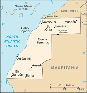
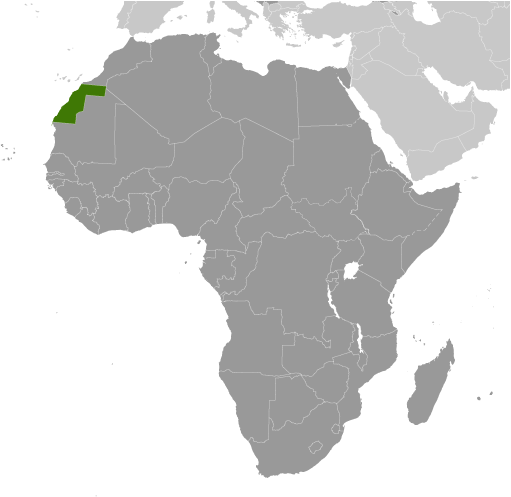
Western Sahara [ Undetermined ] (El Aaiun):

Advertisement


GPS points near Guerd Langra

square El Uarma (5 km)

square Bir Gandus (9 km)

square Bir Gauduz (9 km)

square Punta Gorda (9 km)

square Bir Guendouz (9 km)

square Bir Guendouze (9 km)

square Bir Guenduz (9 km)

square Bir Kandux (9 km)

square Bir Quendouz (9 km)

square Gleib Archan (9 km)

square Gleit Archan (9 km)

square Anzarane (11 km)

square Bir Gandus (11 km)

square Bir Ganduz (11 km)

square Talhet Naima (11 km)


GPS points from Western Sahara [ Undetermined ] (El Aaiun)

square Uad Lgseiseha Western Sahara (general)

square El Manhar Western Sahara (general)

square Graret Isarguiin Western Sahara (general)

square Graret Lagtou'a Western Sahara (general)

square Graret Nos Western Sahara (general)

square Uad Tarf Western Sahara (general)

square Sebjet Larui Bu Garn Western Sahara (general)

square Uad Aunin Western Sahara (general)


viewweather.com sv.ViewWeather.com
fr.ViewWeather.com
da.ViewWeather.com
de.ViewWeather.com
es.ViewWeather.com
www.carpati.org
www.searchromania.net
Deblocari usi
es.getamap.org
fr.getamap.org
de.getamap.org
nl.getamap.org
da.getamap.org
www.getamap.org
Links
Terms of use
Privacy policy

# 0.0598 sec 

contact AT getamap.net

© 2006 - 2024  https://www.getamap.net/