|
|
|
Advertisements:
GeographyLocation
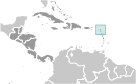
Caribbean, islands between the Caribbean Sea and the North Atlantic Ocean, east-southeast of Puerto Rico Geographic coordinates
17 03 N, 61 48 W
Map references
Central America and the Caribbean
Area World Ranking: 200
Total
442.6 sq km (Antigua 280 sq km; Barbuda 161 sq km) Land 442.6 sq kmWater 0 sq km Note Includes Redonda, 1.6 sq km Area - comparative
2.5 times the size of Washington, DC Land boundaries
0 km
Coastline
153 km
Maritime claims
Territorial sea 12 nm
Contiguous zone 24 nm Exclusive economic zone 200 nm Continental shelf 200 nm or to the edge of the continental margin Climate
Tropical maritime; little seasonal temperature variation Terrain
Mostly low-lying limestone and coral islands, with some higher volcanic areas Elevation extremes
Lowest point Caribbean Sea 0 m
Highest point Boggy Peak 402 m Natural resources
NEGL; pleasant climate fosters tourism Land use
Arable land 18.18%
Permanent crops 4.55% Other 77.27% (2005) Irrigated land
1.3 sq km
Total renewable water resources
0.1 cu km (2000)
Freshwater withdrawal (domestic/industrial/agricultural)
Total 0.005 cu km/yr (60%/20%/20%)
Per capita 63 cu m/yr (1990) Natural hazards
Hurricanes and tropical storms (July to October); periodic droughts Environment - current issues
Water management - a major concern because of limited natural freshwater resources - is further hampered by the clearing of trees to increase crop production, causing rainfall to run off quickly Environment - international agreements
Party to
Biodiversity, Climate Change, Climate Change-Kyoto Protocol, Desertification, Endangered Species, Environmental Modification, Hazardous Wastes, Law of the Sea, Marine Dumping, Ozone Layer Protection, Ship Pollution, Wetlands, Whaling Signed, but not ratified None of the selected agreements Geography - note
Antigua has a deeply indented shoreline with many natural harbors and beaches; Barbuda has a large western harbor
Comments
Add a new comment: |
Advertisement
Members area
Antigua And Barbuda (Saint John's):
 
GPS points from Antigua And Barbuda (Saint John's)
|
||||||||

 The Siboney were the first people to inhabit the islands of Antigua and Barbuda in 2400 B.C., but Arawak Indians populated the islands when COLUMBUS landed on his second voyage in 1493. Early Spanish and French settlements were succeeded by an English colony in 1667. Slavery, established to run the sugar plantations on Antigua, was abolished in 1834. The islands became an independent state within the British Commonwealth of Nations in 1981.