|
|
|
Advertisements:
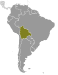
GeographyLocation
Central South America, southwest of Brazil Geographic coordinates
17 00 S, 65 00 W
Map references
South America
Area World Ranking: 28
Total 1,098,581 sq km
Land 1,083,301 sq km Water 15,280 sq km Area - comparative
Slightly less than three times the size of Montana Land boundaries
Total 6,940 km
Border countries Argentina 832 km, Brazil 3,423 km, Chile 860 km, Paraguay 750 km, Peru 1,075 km Coastline
0 km (landlocked)
Maritime claims
None (landlocked)
Climate
Varies with altitude; humid and tropical to cold and semiarid Terrain
Rugged Andes Mountains with a highland plateau (Altiplano), hills, lowland plains of the Amazon Basin Elevation extremes
Lowest point Rio Paraguay 90 m
Highest point Nevado Sajama 6,542 m Natural resources
Tin, natural gas, petroleum, zinc, tungsten, antimony, silver, iron, lead, gold, timber, hydropower Land use
Arable land 2.78%
Permanent crops 0.19% Other 97.03% (2005) Irrigated land
1,500 sq km (2003)
Total renewable water resources
622.5 cu km (2000)
Freshwater withdrawal (domestic/industrial/agricultural)
Total 1.44 cu km/yr (13%/7%/81%)
Per capita 157 cu m/yr (2000) Natural hazards
Flooding in the northeast (March to April) Volcanism Volcanic activity in Andes Mountains on the border with Chile; historically active volcanoes in this region are Irruputuncu (elev. 5,163 m), which last erupted in 1995 and Olca-Paruma Environment - current issues
The clearing of land for agricultural purposes and the international demand for tropical timber are contributing to deforestation; soil erosion from overgrazing and poor cultivation methods (including slash-and-burn agriculture); desertification; loss of biodiversity; industrial pollution of water supplies used for drinking and irrigation Environment - international agreements
Party to
Biodiversity, Climate Change, Climate Change-Kyoto Protocol, Desertification, Endangered Species, Hazardous Wastes, Law of the Sea, Marine Dumping, Ozone Layer Protection, Ship Pollution, Tropical Timber 83, Tropical Timber 94, Wetlands Signed, but not ratified Environmental Modification, Marine Life Conservation Geography - note
Landlocked; shares control of Lago Titicaca, world's highest navigable lake (elevation 3,805 m), with Peru
Comments
Add a new comment: |
Advertisement
Members area
Bolivia (Sucre):
 
GPS points from Bolivia (Sucre)
|
||||||||

 Bolivia, named after independence fighter Simon BOLIVAR, broke away from Spanish rule in 1825; much of its subsequent history has consisted of a series of nearly 200 coups and countercoups. Democratic civilian rule was established in 1982, but leaders have faced difficult problems of deep-seated poverty, social unrest, and illegal drug production. In December 2005, Bolivians elected Movement Toward Socialism leader Evo MORALES president - by the widest margin of any leader since the restoration of civilian rule in 1982 - after he ran on a promise to change the country's traditional political class and empower the nation's poor, indigenous majority. However, since taking office, his controversial strategies have exacerbated racial and economic tensions between the Amerindian populations of the Andean west and the non-indigenous communities of the eastern lowlands. In December 2009, President MORALES easily won reelection, and his party took control of the legislative branch of the government, which will allow him to continue his process of change. In October 2011, the country held its first judicial elections to appoint judges to the four highest courts.