|
|
|
Advertisements:
GeographyLocation
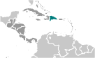
Caribbean, eastern two-thirds of the island of Hispaniola, between the Caribbean Sea and the North Atlantic Ocean, east of Haiti Geographic coordinates
19 00 N, 70 40 W
Map references
Central America and the Caribbean
Area World Ranking: 132
Total 48,670 sq km
Land 48,320 sq km Water 350 sq km Area - comparative
Slightly more than twice the size of New Hampshire Land boundaries
Total 360 km
Border countries Haiti 360 km Coastline
1,288 km
Maritime claims
Measured from claimed archipelagic straight baselines Territorial sea 6 nmContiguous zone 24 nm Exclusive economic zone 200 nm Continental shelf 200 nm or to the edge of the continental margin Climate
Tropical maritime; little seasonal temperature variation; seasonal variation in rainfall Terrain
Rugged highlands and mountains with fertile valleys interspersed Elevation extremes
Lowest point Lago Enriquillo -46 m
Highest point Pico Duarte 3,175 m Natural resources
Nickel, bauxite, gold, silver
Land use
Arable land 22.49%
Permanent crops 10.26% Other 67.25% (2005) Irrigated land
2,750 sq km (2003)
Total renewable water resources
21 cu km (2000)
Freshwater withdrawal (domestic/industrial/agricultural)
Total 3.39 cu km/yr (32%/2%/66%)
Per capita 381 cu m/yr (2000) Natural hazards
Lies in the middle of the hurricane belt and subject to severe storms from June to October; occasional flooding; periodic droughts Environment - current issues
Water shortages; soil eroding into the sea damages coral reefs; deforestation Environment - international agreements
Party to
Biodiversity, Climate Change, Climate Change-Kyoto Protocol, Desertification, Endangered Species, Hazardous Wastes, Marine Dumping, Marine Life Conservation, Ozone Layer Protection, Ship Pollution, Wetlands Signed, but not ratified Law of the SeaGeography - note
Shares island of Hispaniola with Haiti
Comments
Add a new comment: |
Advertisement
Members area
Dominican Republic (Santo Domingo):
 
GPS points from Dominican Republic (Santo Domingo)
|
||||||||

 The Taino - indigenous inhabitants of Hispaniola prior to the arrival of the Europeans - divided the island into five chiefdoms and territories. Christopher COLUMBUS explored and claimed the island on his first voyage in 1492; it became a springboard for Spanish conquest of the Caribbean and the American mainland. In 1697, Spain recognized French dominion over the western third of the island, which in 1804 became Haiti. The remainder of the island, by then known as Santo Domingo, sought to gain its own independence in 1821 but was conquered and ruled by the Haitians for 22 years; it finally attained independence as the Dominican Republic in 1844. In 1861, the Dominicans voluntarily returned to the Spanish Empire, but two years later they launched a war that restored independence in 1865. A legacy of unsettled, mostly non-representative rule followed, capped by the dictatorship of Rafael Leonidas TRUJILLO from 1930 to 1961. Juan BOSCH was elected president in 1962 but was deposed in a military coup in 1963. In 1965, the United States led an intervention in the midst of a civil war sparked by an uprising to restore BOSCH. In 1966, Joaquin BALAGUER defeated BOSCH in an election to become president. BALAGUER maintained a tight grip on power for most of the next 30 years when international reaction to flawed elections forced him to curtail his term in 1996. Since then, regular competitive elections have been held in which opposition candidates have won the presidency. Former President Leonel FERNANDEZ Reyna (first term 1996-2000) won election to a new term in 2004 following a constitutional amendment allowing presidents to serve more than one term, and was since reelected to a second consecutive term.