|
|
|
Advertisements:
MilitaryMilitary branches
Uganda Peoples Defense Force (UPDF): Army (includes Marine Unit), Uganda Air Force (2010) Military service age and obligation
18-26 years of age for voluntary military duty; 18-30 years of age for professionals; no conscription; 9-year service obligation; the government has stated that recruitment under 18 years of age could occur with proper consent and that "no person under the apparent age of 13 years shall be enrolled in the armed forces"; Ugandan citizenship and secondary education required (2010) Manpower available for military service
Males age 16-49 7,249,271
Females age 16-49 7,025,439 (2010 est.) Manpower fit for military service
Males age 16-49 4,313,068
Females age 16-49 4,200,901 (2010 est.) Manpower reaching militarily significant age annually
Male 423,923
Female 420,236 (2010 est.) Military expenditures World Ranking: 66
2.2% of GDP (2006)
Comments
Add a new comment: |
Advertisement
Members area
Uganda (Kampala):
 
GPS points from Uganda (Kampala)
|
||||||||

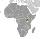 The colonial boundaries created by Britain to delimit Uganda grouped together a wide range of ethnic groups with different political systems and cultures. These differences prevented the establishment of a working political community after independence was achieved in 1962. The dictatorial regime of Idi AMIN (1971-79) was responsible for the deaths of some 300,000 opponents; guerrilla war and human rights abuses under Milton OBOTE (1980-85) claimed at least another 100,000 lives. The rule of Yoweri MUSEVENI since 1986 has brought relative stability and economic growth to Uganda. During the 1990s, the government promulgated non-party presidential and legislative elections.