|
|
|
Advertisements:
GeographyLocation
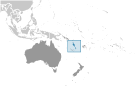
Oceania, group of islands in the South Pacific Ocean, about three-quarters of the way from Hawaii to Australia Geographic coordinates
16 00 S, 167 00 E
Map references
Oceania
Area World Ranking: 164
Total 12,189 sq km
Land 12,189 sq km Water 0 sq km Note Includes more than 80 islands, about 65 of which are inhabited Area - comparative
Slightly larger than Connecticut Land boundaries
0 km
Coastline
2,528 km
Maritime claims
Measured from claimed archipelagic baselines Territorial sea 12 nmContiguous zone 24 nm Exclusive economic zone 200 nm Continental shelf 200 nm or to the edge of the continental margin Climate
Tropical; moderated by southeast trade winds from May to October; moderate rainfall from November to April; may be affected by cyclones from December to April Terrain
Mostly mountainous islands of volcanic origin; narrow coastal plains Elevation extremes
Lowest point Pacific Ocean 0 m
Highest point Tabwemasana 1,877 m Natural resources
Manganese, hardwood forests, fish Land use
Arable land 1.64%
Permanent crops 6.97% Other 91.39% (2005) Irrigated land
NA
Natural hazards
Tropical cyclones or typhoons (January to April); volcanic eruption on Aoba (Ambae) island began on 27 November 2005, volcanism also causes minor earthquakes; tsunamis Volcanism Significant volcanic activity with multiple eruptions in recent years; Yasur (elev. 361 m), one of the world's most active volcanoes, has experienced continuous activity in recent centuries; other historically active volcanoes include, Aoba, Ambrym, Epi, Gaua, Kuwae, Lopevi, Suretamatai, and Traitor's Head Environment - current issues
Most of the population does not have access to a reliable supply of potable water; deforestation Environment - international agreements
Party to
Antarctic-Marine Living Resources, Biodiversity, Climate Change, Climate Change-Kyoto Protocol, Desertification, Endangered Species, Law of the Sea, Marine Dumping, Ozone Layer Protection, Ship Pollution, Tropical Timber 94 Signed, but not ratified None of the selected agreements Geography - note
A Y-shaped chain of four main islands and 80 smaller islands; several of the islands have active volcanoes
Comments
Add a new comment: |
Advertisement
Members area
Vanuatu (Port Vila):
 
GPS points from Vanuatu (Port Vila)
|
||||||||

 Multiple waves of colonizers, each speaking a distinct language, migrated to the New Hebrides in the millennia preceding European exploration in the 18th century. This settlement pattern accounts for the complex linguistic diversity found on the archipelago to this day. The British and French, who settled the New Hebrides in the 19th century, agreed in 1906 to an Anglo-French Condominium, which administered the islands until independence in 1980, when the new name of Vanuatu was adopted.