42°28'60" N
1°31'60" E
~2,255m asl
04:48 (CEST - UTC/GMT+2)
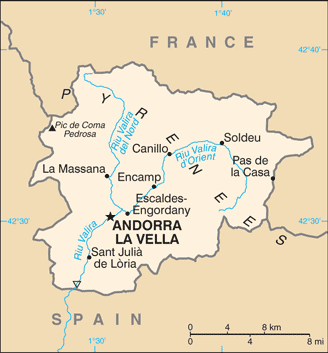
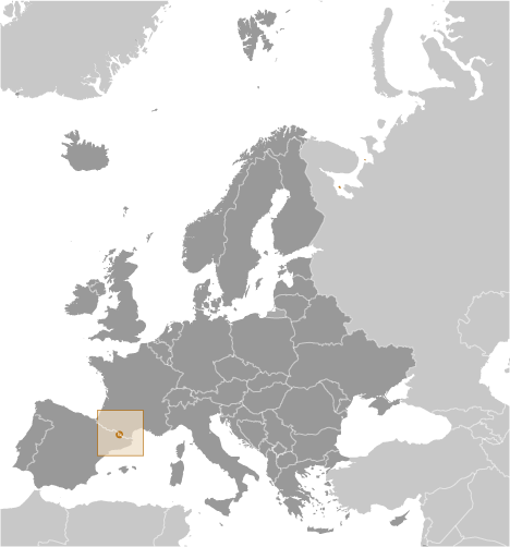
Clots de la Caulla (Clots de la Caülla) is a ravine(s) (class H - Hydrographic) in Andorra (general), Andorra (Europe) with the region font code of Americas/Western Europe. It is located at an elevation of 2,255 meters above sea level.
Its coordinates are 42°28'60" N and 1°31'60" E in DMS (Degrees Minutes Seconds) or 42.4833 and 1.53333 (in decimal degrees). Its UTM position is CH70 and its Joint Operation Graphics reference is NK31-04.
Current local time is 04:48; the sun rises at 07:54 and sets at 20:01 local time (Europe/Andorra UTC/GMT+2). The standard time zone for Clots de la Caulla is UTC/GMT+1, but since Daylight Saving Time (DST) is in effect the current time zone is UTC/GMT+2.
In 2024 DST starts on 31 Mar 2024 and ends on 27 Oct 2024.
A Ravine(s) is a small, narrow, deep, steep-sided stream channel, smaller than a gorge.
|
Advertisements:
Advertisements:
|
Weather Clots de la Caülla (Cloud cover, Temperature, Wind speed and Precipitation mm probab.)
Thu
Apr 25
~4 l/m2 72%
2-4 cm (Snow)
-7 °C min
-4 °C max
11 km/h
Thu Jan 1
|
Fri
Apr 26
~8 l/m2 73%
5-8 cm (Snow)
-9 °C min
-3 °C max
13 km/h
Thu Jan 1
|
Sat
Apr 27
~43 l/m2 97%
25-43 cm (Snow)
-8 °C min
-4 °C max
16 km/h
Thu Jan 1
|
Sun
Apr 28
~21 l/m2 97%
12-21 cm (Snow)
-8 °C min
-2 °C max
12 km/h
Thu Jan 1
|
Mon
Apr 29
~37 l/m2 97%
22-37 cm (Snow)
-8 °C min
-5 °C max
8 km/h
Thu Jan 1
|
Tue
Apr 30
~47 l/m2 97%
28-47 cm (Snow)
-8 °C min
-4 °C max
9 km/h
Thu Jan 1
|
|
|
Obaga del Riguer (Andorra (general)) 7 day forecast
Map and Photos Clots de la Caulla
--- There are no comments yet ---
Add a new comment:
|
Members area
Andorra (Andorra La Vella):
Advertisement
GPS points near Clots de la Caülla
GPS points from Andorra (Andorra La Vella)
|
 Serra de la Creu (1 km)