|
|
|
Ta-pai Shan
Weather Ta-pai Shan (Cloud cover, Temperature, Wind speed and Precipitation mm probab.)
Map and Photos Ta-pai Shan
Comments
Add a new comment: |
Members area
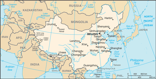
China (Beijing):
Advertisement
GPS points near Ta-pai Shan
 Taibai Ding (0.5km)
Ta-pai Shan (0.5km)
Tongbai Shan (0.5km)
T'ung-pai Shan (0.5km)
Tongbai Shan (0.5km)
T'ung-pai Shan (0.5km)
Tungpeh-shan (0.5km)
Gumiao (4 km)
Ku-miao (4 km)
Jiebeikou (8 km)
Xiehe (8 km)
Hsin-ch'eng (9 km)
Xincheng (9 km)
Dazhouzhuang (9 km)
Hongyihe (10 km)
Hung-ni-ho (10 km)
Tongbai (11 km)
Taibai Ding (0.5km)
Ta-pai Shan (0.5km)
Tongbai Shan (0.5km)
T'ung-pai Shan (0.5km)
Tongbai Shan (0.5km)
T'ung-pai Shan (0.5km)
Tungpeh-shan (0.5km)
Gumiao (4 km)
Ku-miao (4 km)
Jiebeikou (8 km)
Xiehe (8 km)
Hsin-ch'eng (9 km)
Xincheng (9 km)
Dazhouzhuang (9 km)
Hongyihe (10 km)
Hung-ni-ho (10 km)
Tongbai (11 km)
GPS points from China (Beijing)
|