2°22'0" N
73°7'0" E
~0m asl
11:49 (MVT - UTC/GMT+5)
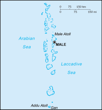
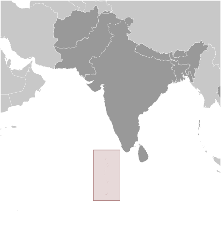
Kolhumadulu (Kolhumadulu) is a first-order administrative division (class A - Administrative Region) in Thaa Atholhu ((MV08)), Maldives (Asia) with the region font code of Americas/Western Europe.. and its population amounts to 9,071.
Kolhumadulu is also known as Kolhumadulu, Kolumadulu Atoll, Ta, Thaa, Thaa Atoll, Tā.
Its coordinates are 2°22'0" N and 73°7'0" E in DMS (Degrees Minutes Seconds) or 2.36667 and 73.1167 (in decimal degrees). Its UTM position is BC96 and its Joint Operation Graphics reference is NA43-05.
Current local time is 11:49; the sun rises at 08:53 and sets at 21:00 local time (Indian/Maldives UTC/GMT+5). The standard time zone for Kolhumadulu is UTC/GMT+5
In 2024 DST starts on - and ends on -.
A First-order administrative division is a primary administrative division of a country, such as a state in the United States.
|
Advertisements:
Advertisements:
|
Weather Kolhumadulu (Cloud cover, Temperature, Wind speed and Precipitation mm probab.)
Mon
Apr 29
~14 l/m2 58%
27 °C min
30 °C max
29 km/h
Thu Jan 1
|
Tue
Apr 30
~35 l/m2 95%
26 °C min
29 °C max
30 km/h
Thu Jan 1
|
Wed
May 1
~29 l/m2 96%
26 °C min
29 °C max
32 km/h
Thu Jan 1
|
Thu
May 2
~8 l/m2 63%
29 °C min
30 °C max
29 km/h
Thu Jan 1
|
Fri
May 3
~3 l/m2 60%
29 °C min
30 °C max
16 km/h
Thu Jan 1
|
Sat
May 4
~10 l/m2 66%
28 °C min
30 °C max
25 km/h
Thu Jan 1
|
|
|
Thaa Atholhu (Thaa Atholhu) 7 day forecast
Map and Photos Kolhumadulu
--- There are no comments yet ---
Add a new comment:
|
Advertisement
Members area
Maldives (Male):
GPS points from Maldives (Male)
 Kagi Maldives (general)
|