English   Română   Español   Français   Deutsch  

getamap.net

Africa

Oceania

Asia

North America

Europe

South America

Antarctica


Ana-hen-u-furi


5°21'0" N
72°55'60" E
05:06 (MVT - UTC/GMT+5)

Ana-hen-u-furi (Ana-hen-u-furi) is a island (class T - Hypsographic) in (Maldives (general)), Maldives (Asia) with the region font code of Asia/Pacific.

Its coordinates are 5°21'0" N and 72°55'60" E in DMS (Degrees Minutes Seconds) or 5.35 and 72.9333 (in decimal degrees). Its UTM position is BF79 and its Joint Operation Graphics reference is NB43-09.

Current local time is 05:06; the sun rises at 08:53 and sets at 21:00 local time (Indian/Maldives UTC/GMT+5). The standard time zone for Ana-hen-u-furi is UTC/GMT+5
In 2024 DST starts on - and ends on -.

A Island is a tract of land, smaller than a continent, surrounded by water at high water.


Country
 Advertisements:


 Advertisements:


Weather Ana-hen-u-furi (Cloud cover, Temperature, Wind speed and Precipitation mm probab.)

Sun


Apr 28
Clound 50-40-10-100 Lightning
~14 l/m2 79%
 
28 °C min
29 °C max
18 km/h
Thu Jan 1

Mon


Apr 29
Clound 30-10-0-100 Lightning
~13 l/m2 54%
 
28 °C min
30 °C max
16 km/h
Thu Jan 1

Tue


Apr 30
Clound 30-10-20-100 Lightning
~19 l/m2 72%
 
28 °C min
30 °C max
18 km/h
Thu Jan 1

Wed


May 1
Clound 10-10-10-90
~2 l/m2 37%
 
28 °C min
30 °C max
19 km/h
Thu Jan 1

Thu


May 2
Clound 20-10-0-90
~2 l/m2 18%
 
29 °C min
30 °C max
18 km/h
Thu Jan 1

Fri


May 3
Clound 0-10-30-100 Lightning
 
29 °C min
30 °C max
16 km/h
Thu Jan 1

Weather Graph

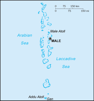
Map and Photos Ana-hen-u-furi


Comments

--- There are no comments yet ---


Add a new comment:


You have to log in to add a comment!


Members area


Register

Forgot password?

Maldives (Male):

Advertisement


GPS points near Ana-hen-u-furi

square Marar (1 km)


square Velengili (3 km)

square Mamnaga (4 km)

square Gaha (4 km)

square Dhigfuri (5 km)

square Kari Faro (5 km)

square Furuwari (5 km)

square Karidu (5 km)

square Medu Faro (6 km)

square Wadu (6 km)

square Boyfuri (6 km)

square Mamanaga Faro (7 km)


square Kiadufuri (7 km)


GPS points from Maldives (Male)

square Felidhu Atholhu Vaavu Atholhu

square Maruri Maldives (general)

square Miladummadulu Atoll Maldives (general)

square Berriam Faro Maldives (general)

square Furi Maldives (general)

square South Nilandhe Atoll Maldives (general)

square Denduni Maldives (general)

square Marar Maldives (general)


viewweather.com sv.ViewWeather.com
fr.ViewWeather.com
da.ViewWeather.com
de.ViewWeather.com
es.ViewWeather.com
www.carpati.org
www.searchromania.net
Deblocari usi
es.getamap.org
fr.getamap.org
de.getamap.org
nl.getamap.org
da.getamap.org
www.getamap.org
Links
Terms of use
Privacy policy

# 0.0813 sec 

contact AT getamap.net

© 2006 - 2024  https://www.getamap.net/