|
Administrative divisions (GPS Maps)
Geography
People and Society
Government
Economy
Communications
Transportation
Military |
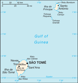 |
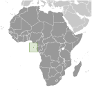 Discovered and claimed by Portugal in the late 15th century, the islands' sugar-based economy gave way to coffee and cocoa in the 19th century - all grown with plantation slave labor, a form of which lingered into the 20th century. While independence was achieved in 1975, democratic reforms were not instituted until the late 1980s. The country held its first free elections in 1991, but frequent internal wrangling between the various political parties precipitated repeated changes in leadership and two failed coup attempts in 1995 and 2003. The recent discovery of oil in the Gulf of Guinea promises to attract increased attention to the small island nation. Discovered and claimed by Portugal in the late 15th century, the islands' sugar-based economy gave way to coffee and cocoa in the 19th century - all grown with plantation slave labor, a form of which lingered into the 20th century. While independence was achieved in 1975, democratic reforms were not instituted until the late 1980s. The country held its first free elections in 1991, but frequent internal wrangling between the various political parties precipitated repeated changes in leadership and two failed coup attempts in 1995 and 2003. The recent discovery of oil in the Gulf of Guinea promises to attract increased attention to the small island nation. |
|
Advertisements
|
Advertisements
|
Administrative divisions (792 GPS Maps)
--- There are no comments yet ---
Add a new comment:
|
Advertisement
Members area
Sao Tome And Principe (Sao Tome):
GPS points from Sao Tome And Principe (Sao Tome)
|

