|
|
|
Advertisements:
TransportationAirports World Ranking: 7
865 (2012)
Airports - with paved runways
Total 21
Over 3,047 m 4 2,438 to 3,047 m 5 1,524 to 2,437 m 6 914 to 1,523 m 6 (2012) Airports - with unpaved runways
Total 844
Over 3,047 m 1 2,438 to 3,047 m 4 1,524 to 2,437 m 51 914 to 1,523 m 157 Under 914 m 631 (2012) Pipelines
Gas 5,330 km; liquid petroleum gas 51 km; oil 2,510 km; refined products 1,627 km (2010) Railways World Ranking: 46
Total 3,652 km
Narrow gauge 3,652 km 1.000-m gauge (2010) Roadways World Ranking: 119
Total
16,138 km (does not include urban roads) Paved 7,382 kmUnpaved 8,756 km (2004) Waterways World Ranking: 13
10,000 km (commercially navigable almost exclusively in the northern and eastern parts of the country) (2012) Merchant marine World Ranking: 98
Total 18
By type Bulk carrier 1, cargo 14, petroleum tanker 1, roll on/roll off 2 Foreign-owned 5 (Syria 4, UK 1, (2010)Ports and terminals
Puerto Aguirre (inland port on the Paraguay/Parana waterway at the Bolivia/Brazil border); Bolivia has free port privileges in maritime ports in Argentina, Brazil, Chile, and Paraguay
Comments
Add a new comment: |
Advertisement
Members area
Bolivia (Sucre):
 
GPS points from Bolivia (Sucre)
|
||||||||

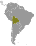 Bolivia, named after independence fighter Simon BOLIVAR, broke away from Spanish rule in 1825; much of its subsequent history has consisted of a series of nearly 200 coups and countercoups. Democratic civilian rule was established in 1982, but leaders have faced difficult problems of deep-seated poverty, social unrest, and illegal drug production. In December 2005, Bolivians elected Movement Toward Socialism leader Evo MORALES president - by the widest margin of any leader since the restoration of civilian rule in 1982 - after he ran on a promise to change the country's traditional political class and empower the nation's poor, indigenous majority. However, since taking office, his controversial strategies have exacerbated racial and economic tensions between the Amerindian populations of the Andean west and the non-indigenous communities of the eastern lowlands. In December 2009, President MORALES easily won reelection, and his party took control of the legislative branch of the government, which will allow him to continue his process of change. In October 2011, the country held its first judicial elections to appoint judges to the four highest courts.