|
|
|
Advertisements:
GeographyLocation
Caribbean, island between the Caribbean Sea and the North Atlantic Ocean, 150 km south of Key West, Florida Geographic coordinates
21 30 N, 80 00 W
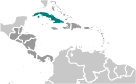
Map references
Central America and the Caribbean
Area World Ranking: 106
Total 110,860 sq km
Land 109,820 sq km Water 1,040 sq km Area - comparative
Slightly smaller than Pennsylvania Land boundaries
Total 29 km
Border countries US Naval Base at Guantanamo Bay 29 km Note Guantanamo Naval Base is leased by the US and remains part of Cuba Coastline
3,735 km
Maritime claims
Territorial sea 12 nm
Contiguous zone 24 nm Exclusive economic zone 200 nm Climate
Tropical; moderated by trade winds; dry season (November to April); rainy season (May to October) Terrain
Mostly flat to rolling plains, with rugged hills and mountains in the southeast Elevation extremes
Lowest point Caribbean Sea 0 m
Highest point Pico Turquino 2,005 m Natural resources
Cobalt, nickel, iron ore, chromium, copper, salt, timber, silica, petroleum, arable land Land use
Arable land 27.63%
Permanent crops 6.54% Other 65.83% (2005) Irrigated land
8,700 sq km (2003)
Total renewable water resources
38.1 cu km (2000)
Freshwater withdrawal (domestic/industrial/agricultural)
Total 8.2 cu km/yr (19%/12%/69%)
Per capita 728 cu m/yr (2000) Natural hazards
The east coast is subject to hurricanes from August to November (in general, the country averages about one hurricane every other year); droughts are common Environment - current issues
Air and water pollution; biodiversity loss; deforestation Environment - international agreements
Party to
Antarctic Treaty, Biodiversity, Climate Change, Climate Change-Kyoto Protocol, Desertification, Endangered Species, Environmental Modification, Hazardous Wastes, Law of the Sea, Marine Dumping, Ozone Layer Protection, Ship Pollution, Wetlands Signed, but not ratified Marine Life ConservationGeography - note
Largest country in Caribbean and westernmost island of the Greater Antilles
Comments
Add a new comment: |
Advertisement
Members area
Cuba (Havana):
 
GPS points from Cuba (Havana)
|
||||||||

 The native Amerindian population of Cuba began to decline after the European discovery of the island by Christopher COLUMBUS in 1492 and following its development as a Spanish colony during the next several centuries. Large numbers of African slaves were imported to work the coffee and sugar plantations, and Havana became the launching point for the annual treasure fleets bound for Spain from Mexico and Peru. Spanish rule eventually provoked an independence movement and occasional rebellions that were harshly suppressed. US intervention during the Spanish-American War in 1898 assisted the Cubans in overthrowing Spanish rule. The Treaty of Paris established Cuban independence from the US in 1902 after which the island experienced a string of governments mostly dominated by the military and corrupt politicians. Fidel CASTRO led a rebel army to victory in 1959; his iron rule held the subsequent regime together for nearly five decades. He stepped down as president in February 2008 in favor of his younger brother Raul CASTRO. Cuba's Communist revolution, with Soviet support, was exported throughout Latin America and Africa during the 1960s, 1970s, and 1980s. The country faced a severe economic downturn in 1990 following the withdrawal of former Soviet subsidies worth $4 billion to $6 billion annually. Cuba at times portrays the US embargo, in place since 1961, as the source if its difficulties. Illicit migration to the US - using homemade rafts, alien smugglers, air flights, or via the southwest border - is a continuing problem. The US Coast Guard intercepted some 1,000 individuals attempting to cross the Straits of Florida in fiscal year 2011.