|
|
|
Advertisements:
TransportationAirports World Ranking: 81
61 (2012)
Airports - with paved runways
Total 22
Over 3,047 m 2 2,438 to 3,047 m 2 1,524 to 2,437 m 13 914 to 1,523 m 5 (2012) Airports - with unpaved runways
Total 39
1,524 to 2,437 m 4 914 to 1,523 m 15 Under 914 m 20 (2012) Heliports
1 (2012)
Roadways World Ranking: 169
Total 2,717 km
Paved 1,560 km Unpaved 1,157 km (2002) Merchant marine World Ranking: 10
Total 1,160
By type Barge carrier 1, bulk carrier 238, cargo 170, carrier 2, chemical tanker 87, combination ore/oil 8, container 57, liquefied gas 71, passenger 102, passenger/cargo 26, petroleum tanker 225, refrigerated cargo 97, roll on/roll off 13, specialized tanker 2, vehicle carrier 61 Foreign-owned 1,063 (Angola 6, Australia 1, Belgium 6, Bermuda 15, Brazil 1, Canada 96, Croatia 1, Cyprus 23, Denmark 69, Finland 8, France 15, Germany 30, Greece 225, Guernsey 6, Hong Kong 3, Indonesia 2, Ireland 3, Italy 1, Japan 88, Jordan 2, Kuwait 1, Malaysia 13, Monaco 8, Montenegro 2, Netherlands 23, Nigeria 2, Norway 186, Poland 34, Saudi Arabia 16, Singapore 7, South Korea 1, Spain 6, Sweden 11, Switzerland 1, Thailand 4, Turkey 3, UAE 23, UK 18, US 109) Registered in other countries 6 (Panama 6) (2010)Ports and terminals
Freeport, Nassau, South Riding Point
Comments
Add a new comment: |
Advertisement
Members area
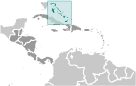
The Bahamas (Nassau):
 
GPS points from The Bahamas (Nassau)
|
||||||||

 Lucayan Indians inhabited the islands when Christopher COLUMBUS first set foot in the New World on San Salvador in 1492. British settlement of the islands began in 1647; the islands became a colony in 1783. Since attaining independence from the UK in 1973, The Bahamas has prospered through tourism and international banking and investment management. Because of its geography, the country is a major transshipment point for illegal drugs, particularly shipments to the US and Europe, and its territory is used for smuggling illegal migrants into the US.