|
|
|
Advertisements:
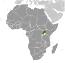
GeographyLocation
East-Central Africa, west of Kenya, east of the Democratic Republic of the Congo Geographic coordinates
1 00 N, 32 00 E
Map references
Africa
Area World Ranking: 81
Total 241,038 sq km
Land 197,100 sq km Water 43,938 sq km Area - comparative
Slightly smaller than Oregon
Land boundaries
Total 2,698 km
Border countries Democratic Republic of the Congo 765 km, Kenya 933 km, Rwanda 169 km, South Sudan 435 km, Tanzania 396 km Coastline
0 km (landlocked)
Maritime claims
None (landlocked)
Climate
Tropical; generally rainy with two dry seasons (December to February, June to August); semiarid in northeast Terrain
Mostly plateau with rim of mountains Elevation extremes
Lowest point Lake Albert 621 m
Highest point Margherita Peak on Mount Stanley 5,110 m Natural resources
Copper, cobalt, hydropower, limestone, salt, arable land, gold Land use
Arable land 21.57%
Permanent crops 8.92% Other 69.51% (2005) Irrigated land
90 sq km (2003)
Total renewable water resources
66 cu km (1970)
Freshwater withdrawal (domestic/industrial/agricultural)
Total 0.3 cu km/yr (43%/17%/40%)
Per capita 10 cu m/yr (2002) Natural hazards
NA
Environment - current issues
Draining of wetlands for agricultural use; deforestation; overgrazing; soil erosion; water hyacinth infestation in Lake Victoria; widespread poaching Environment - international agreements
Party to
Biodiversity, Climate Change, Climate Change-Kyoto Protocol, Desertification, Endangered Species, Hazardous Wastes, Law of the Sea, Marine Life Conservation, Ozone Layer Protection, Wetlands Signed, but not ratified Environmental ModificationGeography - note
Landlocked; fertile, well-watered country with many lakes and rivers
Comments
Add a new comment: |
Advertisement
Members area
Uganda (Kampala):
 
GPS points from Uganda (Kampala)
|
||||||||

 The colonial boundaries created by Britain to delimit Uganda grouped together a wide range of ethnic groups with different political systems and cultures. These differences prevented the establishment of a working political community after independence was achieved in 1962. The dictatorial regime of Idi AMIN (1971-79) was responsible for the deaths of some 300,000 opponents; guerrilla war and human rights abuses under Milton OBOTE (1980-85) claimed at least another 100,000 lives. The rule of Yoweri MUSEVENI since 1986 has brought relative stability and economic growth to Uganda. During the 1990s, the government promulgated non-party presidential and legislative elections.