|
|
|
Advertisements:
Administrative divisions (690 GPS Maps)
Comments
Add a new comment: |
Advertisement
Members area
Antigua And Barbuda (Saint John's):
 
GPS points from Antigua And Barbuda (Saint John's)
|
||||||||
|
|
|
Advertisements:
Administrative divisions (690 GPS Maps)
Comments
Add a new comment: |
Advertisement
Members area
Antigua And Barbuda (Saint John's):
GPS points from Antigua And Barbuda (Saint John's)
|
||||||||

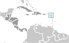 The Siboney were the first people to inhabit the islands of Antigua and Barbuda in 2400 B.C., but Arawak Indians populated the islands when COLUMBUS landed on his second voyage in 1493. Early Spanish and French settlements were succeeded by an English colony in 1667. Slavery, established to run the sugar plantations on Antigua, was abolished in 1834. The islands became an independent state within the British Commonwealth of Nations in 1981.