|
|
Nanny Island
Weather Nanny Island (Cloud cover, Temperature, Wind speed and Precipitation mm probab.)
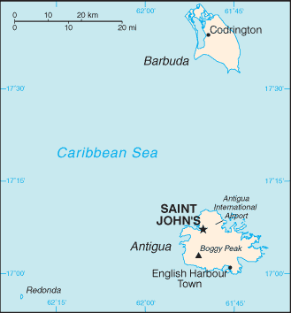
Map and Photos Nanny Island
Comments
Add a new comment: |
Members area
Antigua And Barbuda (Saint John's):
Advertisement
GPS points near Nanny Island
 Conk Point (1 km)
  Ricket Harbor (1 km)
  Ricket Harbour (1 km)
  Rickets Harbour (1 km)
  Rickett Harbor (1 km)
  Rickett Harbour (1 km)
  Ricketts Harbour (1 km)
  Ayres Creek (1 km)
  Cables Creek (1 km)
  Gaynors (1 km)
  Gobles Creek (1 km)
  Hughes Bay (1 km)
  Hughes Cove (1 km)
  Hughes Point (1 km)
  Flat Point (1 km)
  Ledcoff Cove (1 km)
  Ledeatt Cove (1 km)
GPS points from Antigua And Barbuda (Saint John's)
|


