English   Română   Español   Français   Deutsch  

getamap.net

Africa

Oceania

Asia

North America

Europe

South America

Antarctica


Peninha

/ Sao Tome

0°15'0" N
6°36'0" E
~726m asl
04:04 (GMT - UTC/GMT+0)

Peninha (Peninha) is a mountain (class T - Hypsographic) in Sao Tome (São Tomé), Sao Tome And Principe (Africa) with the region font code of Americas/Western Europe. It is located at an elevation of 726 meters above sea level.

Its coordinates are 0°15'0" N and 6°36'0" E in DMS (Degrees Minutes Seconds) or 0.25 and 6.6 (in decimal degrees). Its UTM position is KF32 and its Joint Operation Graphics reference is NA32-13.

Current local time is 04:04; the sun rises at 08:54 and sets at 21:01 local time (Africa/Sao_Tome UTC/GMT+0). The standard time zone for Peninha is UTC/GMT+0
In 2024 DST starts on - and ends on -.

A Mountain is an elevation standing high above the surrounding area with small summit area, steep slopes and local relief of 300m or more.


Country
 Advertisements:


 Advertisements:


Weather Peninha (Cloud cover, Temperature, Wind speed and Precipitation mm probab.)

Thu


Apr 25
Clound 0-0-30-10
 
24 °C min
25 °C max
17 km/h
Thu Jan 1

Fri


Apr 26
Clound 0-10-30-30 Lightning
 
23 °C min
25 °C max
15 km/h
Thu Jan 1

Sat


Apr 27
Clound 10-10-20-90
 
23 °C min
25 °C max
12 km/h
Thu Jan 1

Sun


Apr 28
Clound 10-10-0-60
~1 l/m2 17%
 
23 °C min
25 °C max
20 km/h
Thu Jan 1

Mon


Apr 29
Clound 0-10-10-100
~5 l/m2 32%
 
23 °C min
25 °C max
18 km/h
Thu Jan 1

Tue


Apr 30
Clound 20-10-40-100 Lightning
~8 l/m2 60%
 
23 °C min
25 °C max
18 km/h
Thu Jan 1

Weather Graph

Peninha (Sao Tome) 7 day forecast
 

Map and Photos Peninha


Comments

--- There are no comments yet ---


Add a new comment:


You have to log in to add a comment!


Members area


Register

Forgot password?

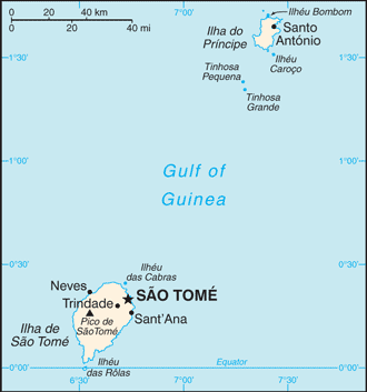
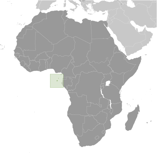
Sao Tome And Principe (Sao Tome):

Advertisement


GPS points near Peninha


square Quinas (1 km)


square Calvario (2 km)

square Pico Calvario (2 km)


square Pico Charuto (3 km)

square Bombaim (3 km)

square Lagoa Amelia (3 km)

square N. Ceilao (3 km)

square N. Ceylao (3 km)

square Palmira (3 km)

square Pinheiro (4 km)

square Macambrara (4 km)


GPS points from Sao Tome And Principe (Sao Tome)

square Praia De Alges Sao Tome

square Praia Faleiros Sao Tome

square Ribeira Papagaio Principe

square Periquito Principe


square Java Sao Tome

square Ponta Cavingui Sao Tome

square Milagrosa Sao Tome


viewweather.com sv.ViewWeather.com
fr.ViewWeather.com
da.ViewWeather.com
de.ViewWeather.com
es.ViewWeather.com
www.carpati.org
www.searchromania.net
Deblocari usi
es.getamap.org
fr.getamap.org
de.getamap.org
nl.getamap.org
da.getamap.org
www.getamap.org
Links
Terms of use
Privacy policy

# 0.3015 sec 

contact AT getamap.net

© 2006 - 2024  https://www.getamap.net/